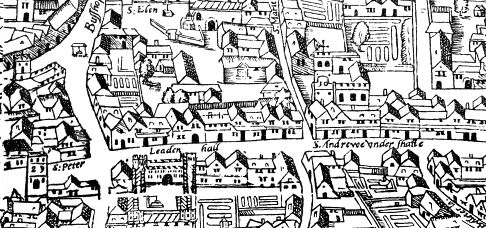
Civitas Londinum is a bird’s-eye view of London first printed from woodblocks in about 1561
John Stow, author of the ‘Survey of London‘ first published in 1598, tells us that there were bonfires and street parties in the City throughout June and July on the Vigils of Festivals. The Vigil is the evening before a festival. A custom that might owe a little to the Celtic choice of dusk as the beginning of the new day.
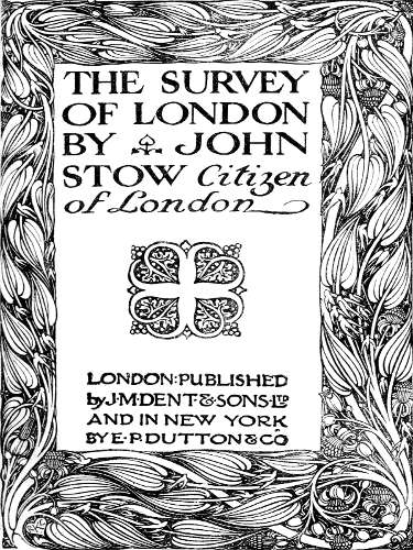
Front cover of the Survey of London by John Stow
Stow does not give a list of the vigils thus celebrated and only mentions those of St John the Baptist and of St Paul and St Peter, (which fall later in June, when I will post about them). But I would guess it would include prominent Saints in the Catholic Calendar, and also Saints with London Churches or Chapels named after them. These might include: St Botolph, St Alban, St James, St Thomas, St Margaret, St Wilgerfortis, St. Mary Magdalen, St Bridget, St James, as well as Saints John, Peter, and Paul. I’m guessing that City wide celebration would be reserved for the most important Saints, and with local celebrations for the Saint on the local Church. I am assuming these celebrations were ended or much reduced after the Reformation.
Here is his introduction to the Vigil celebrations.
‘In the months of June and July, on the vigils of festival days, and on the same festival days in the evenings after the sun setting, there were usually made bonfires in the streets, every man bestowing wood or labour towards them; the wealthier sort also, before their doors near to the said bonfires, would set out tables on the vigils, furnished with sweet bread and good drink, and on the festival days with meats and drinks plentifully, whereunto they would invite their neighbours and passengers also to sit and be merry with them in great familiarity, praising God for his benefits bestowed on them. These were called bonfires as well of good amity amongst neighbours that being before at controversy, were there, by the labour of others, reconciled, and made of bitter enemies loving friends; and also for the virtue that a great fire hath to purge the infection of the air. ‘
He goes on to describe a large scale City wide celebration, which is probably a description of the Midsummer festivities, which I will present on the 21st June.
John Stow is one of the most important sources for Tudor and Medieval London. He was a Londoner, buried in St Andrews Undershaft (see map above), who wrote up all he could glean about London. I use him all the time – for example, on my Wolf Hall Tudor London Walk, which I am doing tomorrow. Stow’s Survey of London can be accessed online, in full, here: or via the wonderful online Agas Map, from which the map above came from.
Roman London – A Literary & Archaeological Walk Sun 11.30 am 31st August 2024 Monument Underground Station To book Tudor London – The City of Wolf Hall Sunday 1.30pm 8th September 2024 Barbican Underground Station To book Jane Austen’s London Sunday 6pm 8th September 2024 Green Park underground station (Green Park exit, by the fountain) To book 1066 and All That Walk Sat 2.30pm 9th Nov 24 Blackfriars Underground Station To book For a complete list of my walks for London Walks in 2024 look here:
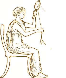
Spinning—showing the distaff in the left hand and the spindle or rock in the right hand
I’m not sure what the Three Kings were doing on the day after Epiphany, but, the shepherds, if they were like English farmworkers, would still be on holiday until next Monday, which is Plough Monday. By contrast, the women, according to folk customs, went back to work on the 7th, St. Distaff’s Day, the day after Epiphany.
A distaff is ‘a stick or spindle on to which wool or flax is wound for spinning’ and because of its importance in the medieval and early modern economy it became a synecdoche for women. St Distaff is a ‘canonisation’ of this use of the word. So, a day to celebrate women.
Robert Herrick (1591–1674), born in Cheapside, a Goldsmith, priest, Royalist and Poet wrote in ‘Hesperides’
Partly work and partly play You must on St. Distaff’s Day: From the plough, soon free your team; Then come home and fother them; If the maids a-spinning go, Burn the flax and fire the tow. Bring in pails of water then, Let the maids bewash the men. Give St. Distaff all the right; Then bid Christmas sport good night, And next morrow every one To his own vocation.
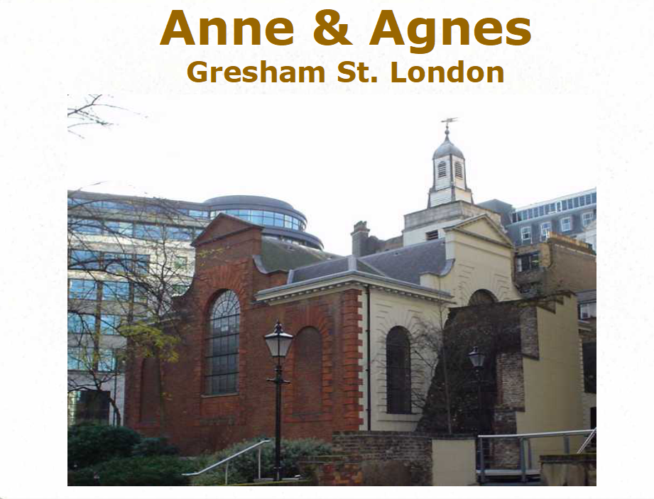
In London, the Fraternity of St Anne and St Agnes used to meet at the Church in London with that name. It is near to the (now closed) Museum of London on the junction of Gresham Street and Noble Street, by a corner of the Roman Wall. St Agnes is the patron saint of young girls, abused women and Girl Scouts. St Anne is the mother of the mother of the Son of God, and, thereby, the three generations of women are represented: maidens, mothers, and grandmothers.
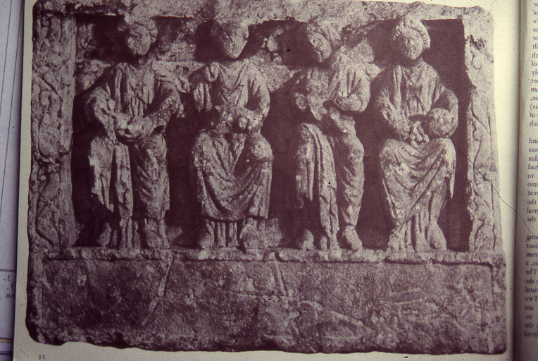
The Three Mother Goddesses (and someone else) “Limestone relief depicting four female figures sitting on a bench holding bread and fruit, a suckling baby, a dog and a basket of fruit’ the Museum of London
Archaeologists discovered the sculpture while investigating the Roman Wall at Blackfriars, City of London. Scholars believe it depicts the Celtic Three Mother Goddesses, worshipped in Roman London. The fourth person is a mystery, maybe the patron of the temple(?) where the relief sculpture was displayed before it was used as rubble and became part of the defences of London.
The idea of triple goddesses is a common one. In Folklore and History they have been referred to as Maiden, Mother, and Crone, or even Maiden, Mother and Hag. They come in Roman, Greek, Celtic, Irish, and Germanic forms with names like the Norns, the Three Fates, the Weird Sisters, the Mórrígan and many more. The Three Fates, the Goddess Book of Days says, were celebrated during the Gamelia, the Greco/Roman January Festival to the marriage of Zeus and Juno. The Festival also gives its name to the Athenian month of January.
Natural History Museum, Oxford, K Flude photo.
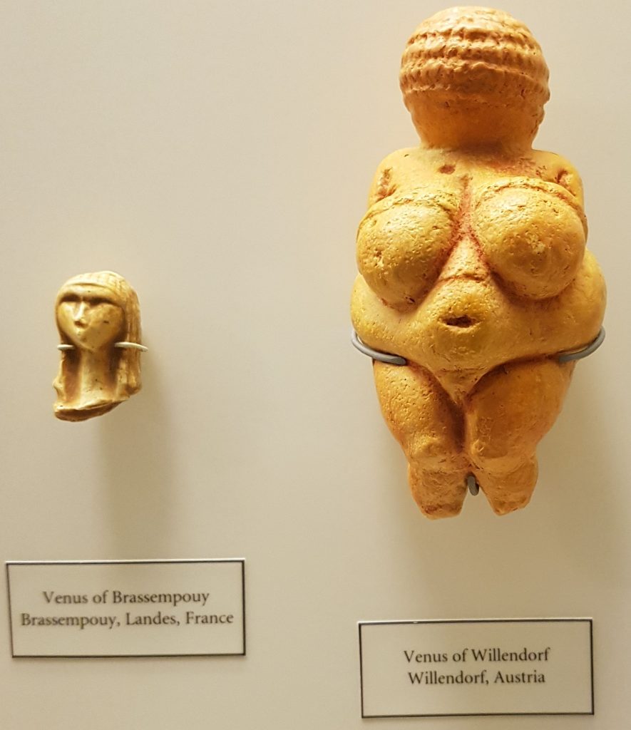
There was a theory widely held that the original Deities, dating before the spread of farming, were mother goddesses (perhaps as depicted by the Venus of Willendorf) who were overthrown by the coming of farmers who worshipped the male gods which destroyed the ancient Matriarchy and replaced it with the current Patriarchy. Jane Ellen Harrison proposed an ancient matriarchal civilization. Robert Graves wrote some interesting, but no longer thought to be very scientific studies, on the idea. Neopaganism has taken these ideas forward.
Whatever the truth of the origins of the Three Mother Goddesses, the use of the terms Hag and Crone for the third is a great disservice to the Grandmother figure. These Goddesses represent the importance of the female for human society. The three phases of womanhood are equally as important in the continuation of the species, providing love, support, and experience through the generations. Compare these three generations of supportive deities with Ouranos (Uranus), Cronus (Saturn) and Zeus (Jupiter). Saturn castrated and deposed his father, Uranus. Later, he tried to eat his son, Jupiter. And then Jupiter is nobody’s idea of an ideal father.
Recent work on human evolution has suggested that the role of the Grandmother might be crucial to our species’ ability to live beyond the age of fertility. Because, in evolutionary terms, once an individual cannot procreate their usefulness for the survival of the genes is finished. So what’s the point of putting resources into their survival? The theory is that, particularly with women, the Grandmother has such an impact on the survival of the next generation, that longevity beyond fertility makes evolutionary sense, and is selected for.
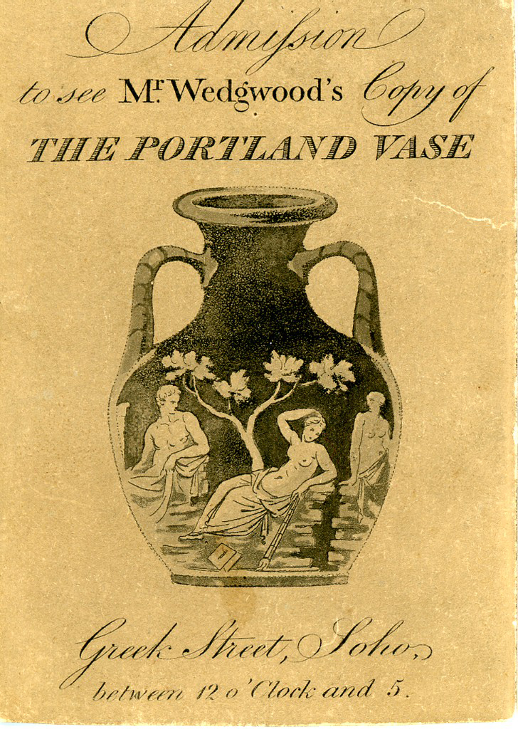
Yesterday was dedicated to Joan of Arc, and today is the anniversary of the breaking of the fabulous Portland Vase in 1845 by a drunken visitor to the British Museum. It looks immaculate despite being smashed into myriad pieces, a wonder of the conservator’s art. To see the vase and read its story, go to the BM web site here:
In the orthodox church, дед Мороз (Ded Moroz= father of frost), accompanied by Cнегурочка (Snieguroshka= fairy of the snow) brings gifts on New year’s eve, (which is on January 7th). He travels with a horse drawn troika.
First Published in 2022, and revised in January 2024
I keep an archive of the walks I have done each year. This is the first entry for 2024.
My new year’s resolutions for my walks are:
Make the Virtual tours shorter.
Try some new technology to make the virtual tours more like a walk.
Begin publishing them.
I should note that 1 and 3 have long been on my list of desired improvements.
Ring in the New Year Virtual Walk
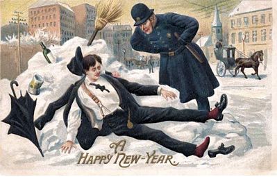
Old New Year Card
Monday 1st January 2024 7.00pm On this Virtual Walk we look at how London has celebrated the New Year over the past 2000 years.
The New Year has been a time of review, renewal and anticipation of the future from time immemorial. The Ancient Britons saw the Solstice as a symbol of a promise of renewal as the Sun was reborn. As the weather turns to bleak mid winter, a festival or reflection and renewal cheers everyone up. This idea of renewal was followed by the Romans, and presided over by a two headed God called Janus who looked both backwards and forwards. Dickens Christmas Carol was based on redemption and his second great Christmas Book ‘The Chimes’ on the renewal that the New Year encouraged.
We look at London’s past to see where and how the New Year was celebrated. We also explore the different New Years we use and their associated Calendars – the Pagan year, the Christian year, the Roman year, the Jewish year, the Financial year, the Academic year and we reveal how these began. We look at folk traditions, Medieval Christmas Festivals, Boy Bishops, Distaff Sunday and Plough Monday, and other Winter Festival and New Year London tradition and folklore.
At the end we use ancient methods to divine what is in store for us in 2024
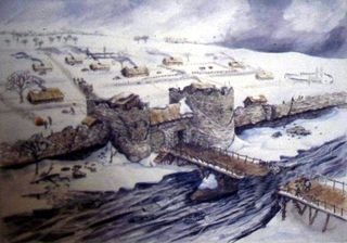
ROMAN LONDON – A LITERARY & ARCHAEOLOGICAL WALK
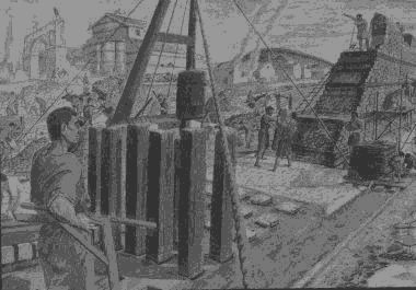
Reconstruction View of Roman Riverside Wall being built
Sunday 21st Jan & 3rd March 2023 11.30 am Monument Underground Station
Our Guides will be Publius Ovidius Naso and Marcus Valerius Martialis who will be helped by Kevin Flude, former Museum of London Archaeologist, Museum Curator and Lecturer.
We disembark at the Roman Waterfront by the Roman Bridge, and then explore the lives of the citizens as we walk up to the site of the Roman Town Hall, and discuss Roman politics. We proceed through the streets of Roman London, with its vivid and cosmopolitan street life via the Temple of Mithras to finish with Bread and Circus at the Roman Amphitheatre.
REVIEWS “Kevin, I just wanted to drop you a quick email to thank you ever so much for your archaeological tours of London! I am so thrilled to have stumbled upon your tours! I look forward to them more than you can imagine! They’re the best 2 hours of my week! 🙂 Best, Sue
Jane Austen’s London Sunday Jan 21st 2.30 pm Green Park underground station,
An exploration of Mayfair, the centre of the London section of Sense & Sensibility and where Jane came to visit her brother
“It is a truth universally acknowledged, that a Jane Austen devotee in possession of the good fortune of a couple of free hours today must be in want of this walk.”
People associate Jane Austen and her characters with a rural setting. But London is central to both Jane Austen’s real life and her literary life. So, this tour will explore Jane’s connections with London and give the background to Sense and Sensibility, a good part of which is based in this very area. We begin with the place Jane’s coach would arrive from Hampshire, and then walk the streets haunted by Willougby; past shops visited by the Palmers, the Ferrars; visit the location of Jane Austen’s brother’s bank and see the publisher of Jane’s Books. The area around Old Bond Street was the home of the Regency elite and many buildings and a surprising number of the shops remain as they were in Jane Austen’s day.
This is a London Walk Guided Walk lead by Kevin Flude
Sat 6pm 25th May 2024 Green Park Tube
Myths, Legends, Archaeology and the Origins of London
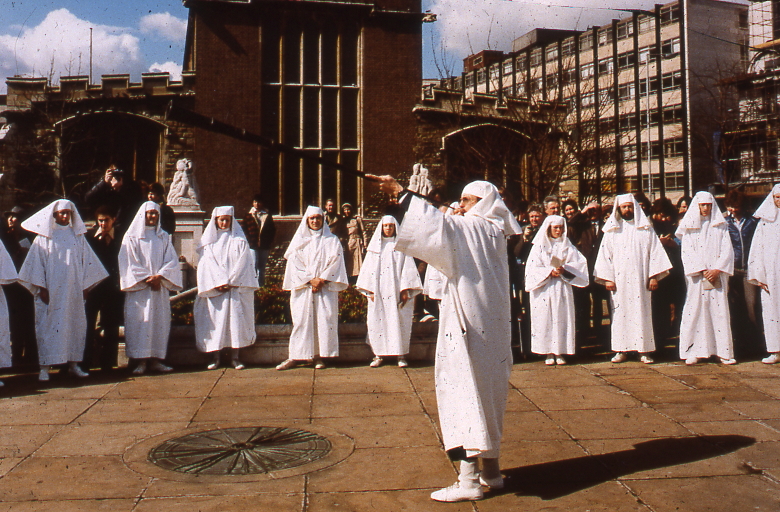
Druids at All Hallows, by the Tower
Sunday 4th February & Saturday 23 March 2024 11.30pm Tower Hill Underground
The walk tells the stories of our changing ideas about the origins of London during the Prehistoric, Roman and Saxon periods.
The walk is led by Kevin Flude, a former archaeologist at the Museum of London, who has an interest both in myths, legends and London’s Archaeology.
The walk will tell the story of the legendary origins of London which record that it was founded in the Bronze Age by an exiled Trojan and was called New Troy, which became corrupted to Trinovantum. This name was recorded in the words of Julius Caesar; and, then, according to Legend, the town was renamed after King Ludd and called Lud’s Dun. Antiquarians and Archaeologists have taken centuries to demolish this idea, and became convinced London was founded by the Romans. Recently, dramatic evidence of a Bronze Age presence in London was found.
When the Roman system broke down in 410 AD, historical records were almost non-existent, until the Venerable Bede recorded the building of St Pauls Cathedral in 604 AD. The two hundred year gap, has another rich selection of legends. which the paucity of archaeological remains struggles to debunk.
The walk will explore these stories and compare the myths and legends with Archaeological discoveries.
The route starts at Tower Hill, then down to the River at Billingsgate, London Bridge, and into the centre of Roman London
Tudor London – The City of Wolf Hall
Sunday 4th February 2024 2.15pm Barbican Underground Station
Tudor London – The City of Wolf Hall Virtual Tour Sunday 4th February 2024 7.30 pm To book
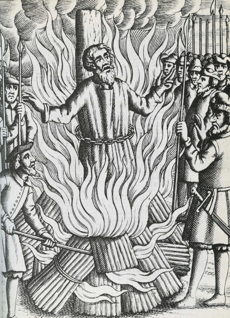
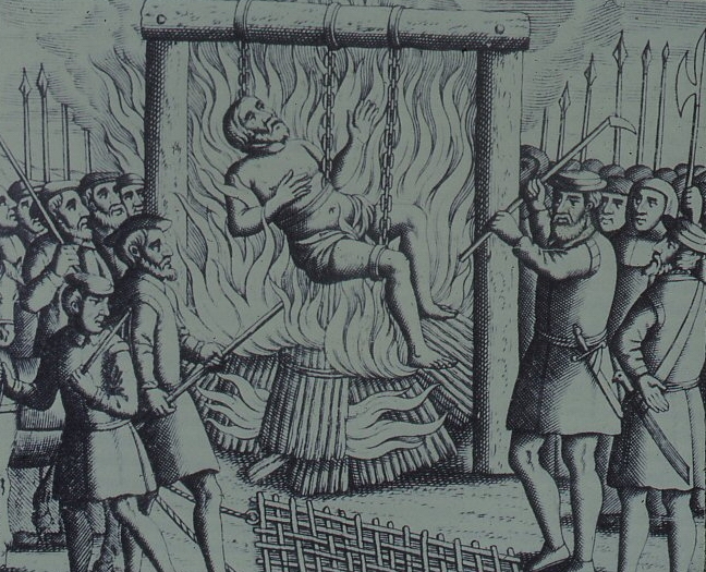
Thomas Bilney martyred in Smithfield.
The Walk creates a portrait of London in the early 16th Century, with particular emphasis on the life and times of Thomas Cromwell and Thomas More during the Anne Boleyn years.
More and Cromwell had much in common, both lawyers, commoners, who rose to be Lord Chancellor to Henry VIII, and ended their careers on the block at Tower Hill.
The walk starts with an exploration of Smithfield – site of the stake where heretics were burnt alive and of St Bartholomew’s Monastery – given to Richard Rich after his decisive role in the downfall of Thomas More. We continue to St Paul where Martin Luther’s books were burnt, and later, where Puritans preached against dancing round the Maypole.
We walk along the main markets streets of London, to Thomas More’s birthplace, and to the site of More’s and Cromwell’s townhouses before, if time allows, finishing at the site of the Scaffold where More and Cromwell met their ends, overlooking where Anne Boleyn was incarcerated in the Tower of London
The Leap Year Pub Walk Thurs 6pm 29 February 2024 Tower Hill Underground
Sketched from a photo by simple-aign on pixaby
Thurs, 29 February 2024, 6pm Tower Hill Underground
We explore London, the Leap Year and 29th February through history A strange amazing day – and walk – that comes only once every four years. For the rest of the time it does not “exist.” A day – and walk – of temporal tune-up. A day – and walk – of unlocked potential. A day – and a walk – of unlocked London.
As the Sun, Moon and Seasons have different cycles and don’t fit into a set number of days, Londoners have had to cope with fixes to their Calendars to align the Cosmos with everyday life. As we walk through the streets of the ancient City of London, we explore how Londoners organised and celebrated their year throughout history
One of the most popular forms of publication in London was the Almanac. It was full of seasonal advice, of prophecy, traditional wisdom, and important events past and future. We will look at Almanacs and Diaries to find how Londoners spent their Leap Year.
We start with the Romans at the City Wall, near the Tower of London, and walk through history until we reach a historic pub to celebrate the New Year.
The Leap Year Almanac of the Past Pub Walk is led by Kevin Flude, a lecturer, curator and former archaeologist at the Museum of London. Join him to explore London’s History through its celebrations, festivals, calendars and almanacs.
This is a London Walks Guided Walk.
Roman London – A Literary & Archaeological Walk Sun 11.30 am 3rd March 2024 Monument Underground Station To book Jane Austen’s London Sun 2.30 pm 3rd March 2024 Green Park Underground station (Green Park Exit. Fountain in Green Park), To book Myths, Legends, Archaeology and the Origins of London Sunday 11.30am 23rd March 2024 Tower Hill Underground
London. 1066 and All That Walk
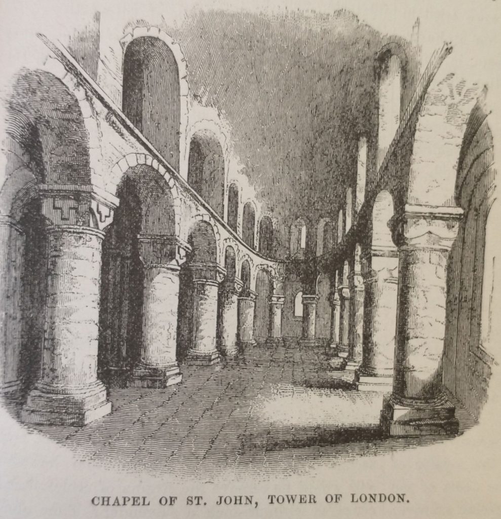
Old illustration Chapel of St Johns Tower of London
Sunday 2.30pm 23rd March 2024 Blackfriars Underground Station The Archaeological Walk that explores the City of London at the end of the Saxon period and at the beginning of the Norman.
The Norman Conquest of 1066 defines Britain in a way unmatched by any other event. And on this walk we explore the London that William conquered and how he changed England for all time.
London was England’s most important City, but not yet the capital. It was crucial to William in his attempt to conquer the realm. But his army could not fight their way across the heavily defended London Bridge after the defeat of the English King, Harold, at the Battle of Hastings.
The future of England was in the balance as he ravaged the country seeking a way across the river and to persuade the English that resistance was hopeless.
Once across the river, the English leaders sued for peace, and William was crowned at the newly built Westminster Abbey. The English hoped for a strong King who would rule with the people. But William began by building Castles to oppress the Citizens, and soon swept aside the English Aristocracy and establishment and replaced them with the Conquerors.
This was a death blow to Anglo-Saxon culture, but the City made an accommodation with the new regime and the first Lord Mayor of London was an Englishman.
So, on the walk we explore the Late Saxon City of London, and how it changed in the last 11th and 12th Centuries.
Walk is by Kevin Flude, former Archaeologist at the Museum of London Kevin
Chaucer’s Medieval London Guided Walk
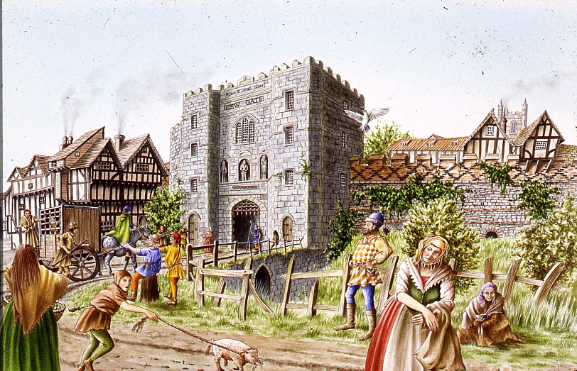
Medieval Newgate
Sunday 7th April 2024 11.30pm & Saturday 6th July 2.30 Aldgate Underground
A Walk around Medieval London following in the footsteps of its resident medieval poet – Geoffrey Chaucer One of the spectators at the Peasants Revolt was Geoffrey Chaucer, born in the Vintry area of London, who rose to be a diplomat, a Courtier and London’s Customs Officer. He lived with his wife in the Chamber above the Gate in the City Wall at Aldgate. His poetry shows a rugged, joyous medieval England including many scenes reflecting life in London. His stories document the ending of the feudal system, growing dissatisfaction with the corruption in the Church, and shows the robust independence with which the English led their lives.
His work helped change the fashion from poetry in French or Latin to acceptance of the English language as suitable literary language. This was helped by the growth of literacy in London as its Merchants and Guildsmen became increasingly successful. In 1422, for example, the Brewers decided to keep their records in English ‘as there are many of our craft who have the knowledge of reading and writing in the English idiom.’
Chaucer and other poets such as Langland give a vivid portrait of Medieval London which was dynamic, successful but also torn by crisis such as the Lollard challenge to Catholic hegemony, and the Peasants who revolted against oppression as the ruling classes struggled to resist the increased independence of the working people following the Black Death.
A walk which explores London in the Middle Ages, We begin at Aldgate, and follow Chaucer from his home to his place of work at the Customs House, and then to St Thomas Chapel on London Bridge, and across the River to where the Canterbury Tales start – at the Tabard Inn.
This is a London Walks event by Kevin Flude
The Decline And Fall Of Roman London Walk
London in the 5th Century Reconstruction painting.
Sat 1.30pm 25th May 2024Exit 2 St Pauls Underground Station
An exploration of what happened at the end of the Roman Period, and how the City became deserted, and then, reborn as an English City
The first British Brexit? The Roman Britons kicked out the Romans in 407AD, and, soon, asked them to come back after a catastrophic collapse. Faced with plague, civil war, invasion, mass immigration, industrial decline, reversion to barter; the authorities struggled against anarchy and descent into a dark age.
But was that how it was? Wasn’t it a rather a transition into the Late Antique period in which life for most people went on much as before except paying taxes to local rulers rather than distant Romans?
The walk investigates why the Roman system in London broke down, and what really was the impact of the end of the Roman system in London? What is the evidence? and can we trust it? Or can we really do nothing much more than guess?
We tramp the streets of London in search of light to shine on the dark age of London.
This is a London Walks event by Kevin Flude, ex Museum of London Archaeology and Museum Curator.
Jane Austen’s London Walk
Saturday 25th May 6pm 2024 Green Park underground station (Green Park exit, by the fountain)
An exploration of Mayfair, the centre of the London section of Sense & Sensibility and where Jane came to visit her brother
“It is a truth universally acknowledged, that a Jane Austen devotee in possession of the good fortune of a couple of free hours today must be in want of this walk.”
People associate Jane Austen and her characters with a rural setting. But London is central to both Jane Austen’s real life and her literary life. So, this tour will explore Jane’s connections with London and give the background to Sense and Sensibility, a good part of which is based in this very area. We begin with the place Jane’s coach would arrive from Hampshire, and then walk the streets haunted by Willougby; past shops visited by the Palmers, the Ferrars; visit the location of Jane Austen’s brother’s bank and see the publisher of Jane’s Books. The area around Old Bond Street was the home of the Regency elite and many buildings and a surprising number of the shops remain as they were in Jane Austen’s day.
This is a London Walk Guided Walk lead by Kevin Flude
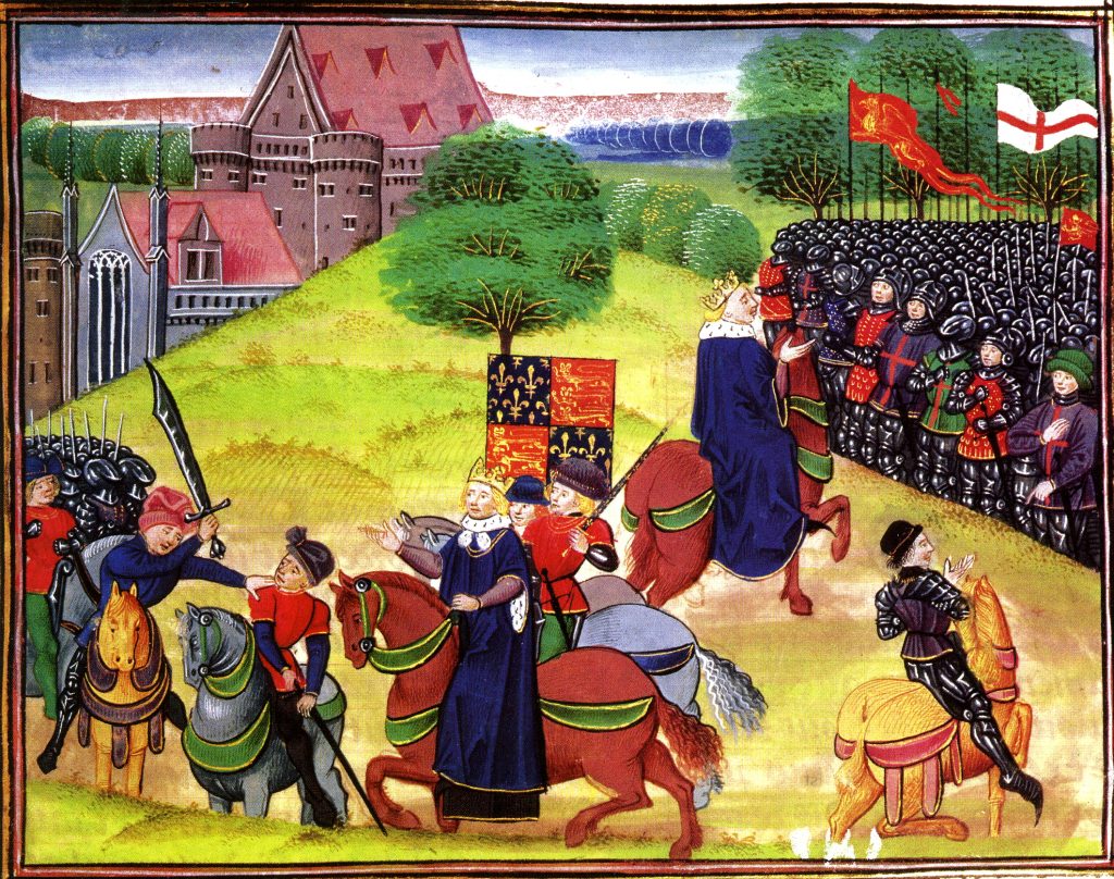
The Peasants Revolt Anniversary Guided Walk
Medieval Manuscript of Peasants Revolt at Smithfield
Aldgate Underground Thursday 6.30 13th June 2024
An Anniversary Walk tracking the progress of the Peasants as they take control of London in June of 1381
The Summer of Blood
The Peasants’ Revolt. The greatest popular rising in English history. This is the anniversary walk. The London Walk that heads back to 1381, back to the Peasants’ Revolt. You want a metaphor, think stations of the cross. This is the stations of the Peasants’ Revolt walk. We go over the ground, literally and metaphorically. Where it took place. Why it took place. Why it took place at these places. What happened. The walk is guided by the distinguished Museum of London Archaeologist His expertise means you’ll see the invisible. And understand the inscrutable.
On the anniversary of the Peasants Revolt we reconstruct the events that shook the medieval world. In June 1381, following the introduction of the iniquitous Poll Tax, England’s government nearly fell, shaken to the core by a revolt led by working men. This dramatic tour follows the events of the Revolt as the Peasants move through London in June 1381.
We met up with the Peasants at Aldgate, force our way into the City. We march on the Tower of London as the King makes concessions by ending serfdom, at Mile End. But the leaders take the mighty Tower of London and behead the leaders of Richard’s government. Attacks follow on the lawyers in the Temple, the Prior at St. John’s of Jerusalem, Flemish Londoners, and on Lambeth and Savoy Palaces.
The climax of the Revolt comes at Smithfield where a small Royal party confront the 30,000 peasants.
Chaucer’s Medieval London Guided Walk
Medieval Newgate
Sat 2.30 6th July 2024 Aldgate Underground
A Walk around Medieval London following in the footsteps of its resident medieval poet – Geoffrey Chaucer
One of the spectators at the Peasants Revolt was Geoffrey Chaucer, born in the Vintry area of London, who rose to be a diplomat, a Courtier and London’s Customs Officer. He lived with his wife in the Chamber above the Gate in the City Wall at Aldgate. His poetry shows a rugged, joyous medieval England including many scenes reflecting life in London. His stories document the ending of the feudal system, growing dissatisfaction with the corruption in the Church, and shows the robust independence with which the English led their lives.
His work helped change the fashion from poetry in French or Latin to acceptance of the English language as suitable literary language. This was helped by the growth of literacy in London as its Merchants and Guildsmen became increasingly successful. In 1422, for example, the Brewers decided to keep their records in English ‘as there are many of our craft who have the knowledge of reading and writing in the English idiom.’
Chaucer and other poets such as Langland give a vivid portrait of Medieval London which was dynamic, successful but also torn by crisis such as the Lollard challenge to Catholic hegemony, and the Peasants who revolted against oppression as the ruling classes struggled to resist the increased independence of the working people following the Black Death.
A walk which explores London in the Middle Ages, We begin at Aldgate, and follow Chaucer from his home to his place of work at the Customs House, and then to St Thomas Chapel on London Bridge, and across the River to where the Canterbury Tales start – at the Tabard Inn.
This is a London Walks event by Kevin Flude
Myths, Legends, Archaeology and the Origins of London
King Bran’s head buried at Tower Hill
Sat 6pm 6th July 2024 Tower Hill Underground
The walk tells the stories of our changing ideas about the origins of London during the Prehistoric, Roman and Saxon periods.
The walk is led by Kevin Flude, a former archaeologist at the Museum of London, who has an interest both in myths, legends and London’s Archaeology.
The walk will tell the story of the legendary origins of London which record that it was founded in the Bronze Age by an exiled Trojan and was called New Troy, which became corrupted to Trinovantum. This name was recorded in the words of Julius Caesar; and, then, according to Legend, the town was renamed after King Ludd and called Lud’s Dun. Antiquarians and Archaeologists have taken centuries to demolish this idea, and became convinced London was founded by the Romans. Recently, dramatic evidence of a Bronze Age presence in London was found.
When the Roman system broke down in 410 AD, historical records were almost non-existent, until the Venerable Bede recorded the building of St Pauls Cathedral in 604 AD. The two hundred year gap, has another rich selection of legends. which the paucity of archaeological remains struggles to debunk.
The walk will explore these stories and compare the myths and legends with Archaeological discoveries.
The route starts at Tower Hill, then down to the River at Billingsgate, London Bridge, and into the centre of Roman London.
On the seventh day of Christmas My true love sent to me: 7 Swans a Swimming; 6 Geese a Laying; 5 Golden Rings; 4 Calling Birds; 3 French Hens; 2 Turtle Doves and a Partridge in a Pear Tree
First an admission, there is a lot of confusion out there as to which is the First day of Christmas. According to my muse, Charles Kightly, the first day of Christmas is Boxing Day, the 26th of December. This makes Twelfth Night January 6th, which is Epiphany – when the three wise men rocked up with their fabulous presents. But that is a Christian day of importance, and most other authorities begin the counting on Christmas Day. So, Twelfth Night is Epiphany Eve, i.e. January 5th. Have a look at Notes&Queries for different viewpoints. One suggestion was that the Church had to accept that the Twelve Days of Christmas were taken up with pagan activities and allowed it to go on until the night before Epiphany. I have gone back and rearranged my days of Christmas accordingly and am I going to take my Christmas decorations down before going to bed on the 5th January. Twelfth Night.
New Year’s Eve
This is a day of preparation, and perhaps of anxiety. Have we got an invitation anywhere tonight? Is anyone going to come to our party? Can I take another blow out feast, a belly full of alcohol and a very late night? For years in my life, New Year’s Eve was spent with my parents watching some inexplicable variety show hosted in Scotland. Google has helped me remember that it was the ‘White Heather Club’ hosted by Andy Stewart. Up to 10 million people watched this between 1960 and 1968. I never understood the pleasure of it, and it seemed a symbol of an old-fashioned world that was passing and irrelevant.
More recently, if not spent at a party, New Year’s Eve is spent with Jools’ Annual Hootenanny, which is a music show masquerading as a live New Year’s Eve party. It features really excellent bands and singers. It is, however, recorded earlier in December (15th, 20th are dates I have seen) and hence a New Year’s fake. Here is a 2007 except starring Madness’s ‘House of Fun’. The fun of this is to spot the stars grooving along to the music.
New Year’s Day needs a lot of preparation. Folklore suggests that this should include finishing off any unfinished work or projects, as a task carried forward is ill-omened. Your accounts for the year should be reconciled, and as Charles Dickens suggests in the Chimes, your moral account with the world should also be addressed so that you can come into the New Year with a clean slate, good conscience and plans for a better new year. And don’t we all need that for 2023!
I update this from time to time to keep track of walks I have done and to keep them on the internet in case anyone is searching for someone to give a walk on one of ‘my’ subjects.
The ‘London Before and After the Roman invasion Walk’ was a brand new walk, although I had done it as a virtual tour.. But as an actual walk it was new and quite a challenge. Although the Roman finds are concentrated in an area that can reasonably be ‘walked’ the prehistoric element is spread all over Greater London. So I did quite a lot of waving my arms and saying ‘Over there, archaeologists found….’ or ‘To the South East was the Kingdom of the Atrebates, whose King Verica fled to the Romans asking their help to regain his throne. ‘ or ‘Claudius crossed the Thames with Nine Elephants some where, almost certainly to the West of us.’ It went quite well, although the sunny weather changed into a downpour which made the climax of the tour a bit of a damp squib.
But I learnt a lot, because it made me read Dominic Perring’s new book on Roman London ‘London in the Roman World’ more closely than I otherwise would have. I should say that I worked with Dominic when we were young archaeologists at the Museum of London. He is now a Professor at the Institute of Archaeology, and, occasionally, I am lucky enough to join him and a few archaeological friends, watching our football team, Tottenham Hotspur.
Tomorrow is my Plough Tuesday as I spent today, my last day of my ‘holiday’ period, bringing my boat up the Regent’s Canal to outside my flat in Hackney and what a glorious January day it was! Tomorrow I have a meeting to sort out my Road Scholar lecturing for the year and Wednesday is my first day lecturing at College.
Below are the walks I have done so far this year
Ring in the New Year Virtual Walk
Old New Year Card
Monday 1st January 2024 7.00pm On this Virtual Walk we look at how London has celebrated the New Year over the past 2000 years.
The New Year has been a time of review, renewal and anticipation of the future from time immemorial. The Ancient Britons saw the Solstice as a symbol of a promise of renewal as the Sun was reborn. As the weather turns to bleak mid winter, a festival or reflection and renewal cheers everyone up. This idea of renewal was followed by the Romans, and presided over by a two headed God called Janus who looked both backwards and forwards. Dickens Christmas Carol was based on redemption and his second great Christmas Book ‘The Chimes’ on the renewal that the New Year encouraged.
We look at London’s past to see where and how the New Year was celebrated. We also explore the different New Years we use and their associated Calendars – the Pagan year, the Christian year, the Roman year, the Jewish year, the Financial year, the Academic year and we reveal how these began. We look at folk traditions, Medieval Christmas Festivals, Boy Bishops, Distaff Sunday and Plough Monday, and other Winter Festival and New Year London tradition and folklore.
At the end we use ancient methods to divine what is in store for us in 2023..
The virtual walk finds interesting and historic places in the City of London to link to our stories of Past New Year’s Days. We begin with the Druids at Tower Hill, and walk around the Roman City of London, and through London History until we get to St Pauls Cathedral
The London Winter Solstice Virtual Tour
Druids at All Hallows, by the Tower
Fri 22 Dec 2023 19:30
We explore London’s History through its celebrations, festivals, calendars and almanacs of the Winter Solstice
Winter Solstice festivals have been a time of review, renewal and anticipation of the future from time immemorial. The Ancient Britons saw the Solstice as a symbol of a promise of renewal as the world entered bleak mid winter. The Roman season was presided over by Janus, a two headed God who looked both backwards and forwards, and Dickens based his second great Christmas Book on the renewal that the New Year encouraged.
We look at London’s past to see where and how the Solstice might be celebrated. We also explore the different Calendars – the Pagan year, the Christian year, the Roman year, the Jewish year, the Financial year, the Academic year and we reveal how these began. We look at folk traditions, Medieval Christmas Festivals, Boy Bishops, Distaff Sunday and Plough Monday, and other London winter traditions and folklore.
At the end we use ancient methods to divine what is in store for us in 2023.
An exploration of Mayfair, the centre of the London section of Sense & Sensibility and where Jane came to visit her brother
“It is a truth universally acknowledged, that a Jane Austen devotee in possession of the good fortune of a couple of free hours today must be in want of this walk.”
People associate Jane Austen and her characters with a rural setting. But London is central to both Jane Austen’s real life and her literary life. So, this tour will explore Jane’s connections with London and give the background to Sense and Sensibility, a good part of which is based in this very area. We begin with the place Jane’s coach would arrive from Hampshire, and then walk the streets haunted by Willougby; past shops visited by the Palmers, the Ferrars; visit the location of Jane Austen’s brother’s bank and see the publisher of Jane’s Books. The area around Old Bond Street was the home of the Regency elite and many buildings and a surprising number of the shops remain as they were in Jane Austen’s day.
This is a London Walk Guided Walk lead by Kevin Flude
We look at how Jane Austen spent Christmas and at Georgian Christmas traditions and amusements.
“It is a truth universally acknowledged, that a Jane Austen devotee in possession of the good fortune of a couple of free hours must be in want of this virtual walk.”
This is a special walk, which looks at the traditions of Christmas during the Regency period and how Jane Austen might have celebrated it. It will give some background to Jane Austen’s life and her knowledge of London. We used her novels and her letters to find out what she might have done at Christmas, but also at how Christmas was kept in this period, and the range of ‘Curiosities, Amusements, Exhibitions, Public Establishments, and Remarkable Objects in and near London available to enjoy.
This is a London Walks Guided Walk by Kevin Flude, Museum Curator and Lecturer.
Review: ‘Thanks, again, Kevin. These talks are magnificent!’
Roman London – A Literary & Archaeological Walk Saturday 16 Dec & 21st Jan 2023 11.30 am Monument Underground Station To book
Dickens London. Life, Work and Christmas Virtual Tour
From ‘Old Christmas’ by Washington Irving
Friday 15th December 2023 7.30pm
A Virtual Tour of Dickens London with a dash of Dickensian Christmas
The Virtual Tour weaves an exploration of Victorian London with Dickens London Life and writing. On the tour we have a look at London at Christmas and the contribution Dickens made to it by his Christmas Books
Dickens writing always has a moral element as exemplified by his Christmas Books. ‘Christmas Carol’ was based on redemption and his second great Christmas Book ‘The Chimes’ on the renewal that the New Year encouraged.
We start in Southwark, visit sites associated with the Christmas Books and others and end at Staple Inn with the Christmas Book ‘The Haunted Man’.
Chaucer’s Medieval London Guided Walk
Medieval City Gate
Aldgate Underground Sunday 12 November 2023 11.30pm
A Walk around Medieval London following in the footsteps of its resident medieval poet – Geoffrey Chaucer
One of the spectators at the Peasants Revolt was Geoffrey Chaucer, born in the Vintry area of London, who rose to be a diplomat, a Courtier and London’s Customs Officer. He lived with his wife in the Chamber above the Gate in the City Wall at Aldgate. His poetry shows a rugged, joyous medieval England including many scenes reflecting life in London. His stories document the ending of the feudal system, growing dissatisfaction with the corruption in the Church, and shows the robust independence with which the English led their lives.
His work helped change the fashion from poetry in French or Latin to acceptance of the English language as suitable literary language. This was helped by the growth of literacy in London as its Merchants and Guildsmen became increasingly successful. In 1422, for example, the Brewers decided to keep their records in English ‘as there are many of our craft who have the knowledge of reading and writing in the English idiom.’
Chaucer and other poets such as Langland give a vivid portrait of Medieval London which was dynamic, successful but also torn by crisis such as the Lollard challenge to Catholic hegemony, and the Peasants who revolted against oppression as the ruling classes struggled to resist the increased independence of the working people following the Black Death.
A walk which explores London in the Middle Ages, We begin at Aldgate, and follow Chaucer from his home to his place of work at the Customs House, and then to St Thomas Chapel on London Bridge, and across the River to where the Canterbury Tales start – at the Tabard Inn.
This is a London Walks event by Kevin Flude
London before and after The Roman Invasion
View of London from the SE as it might have looked before the Roman Invasion
October 29th
The walk looks into the evidence for a prehistoric London and tells the story of the coming of the Romans in AD43
The walk is led by Kevin Flude, a former archaeologist at the Museum of London.
The walk investigates the City of London before and after the the Roman Conquest. What is the evidence for settlement before the Romans set up town of Londinium? Why did the Romans establish the town on this spot? Who were the early Roman Londoners and what made their choice of site so successful?
The fledgling Town was then burnt down by Queen Boudiccan and her Icenian rebels. We look at the evidence for the Revolt and London’s recovery to became the capital of Britain.
This is a London Walks Guided Walk. Look at their web site for a list of other of their amazing walks.
REVIEWS (from London Walks website) “Kevin, I just wanted to drop you a quick email to thank you ever so much for your archaeological tours of London! I am so thrilled to have stumbled upon your tours! I look forward to them more than you can imagine! They’re the best 2 hours of my week! 🙂 Best, Sue
London Before London – Prehistoric London Virtual Walk
View of London from the SE as it might have looked before the Roman Invasion
October 29th
An exploration of London before the foundation of Londinium
It was long thought that London was founded by a Trojan Exile in the Late Bronze Age. But historical analysis and archaeological excavation gradually demoted the idea to a myth.
On this tour we explore what was in the London area before the Romans. We begin at Heathrow and tour Greater London for evidence from the Paleolithic to the invasion of the Emperor Claudius.
We concentrate on the period since the introduction of farming, and bring together evidence for the prehistoric Kingdoms that controlled the area on the eve of the Invasion. We look for henges, barrows, hill forts, hut circles and look at genetic evidence for identity of prehistoric Londoners. The tour will end in the City.
This is a London Walks event by Kevin Flude, ex Museum of London Archaeology and Museum Curator
The Peasants Revolt Anniversary Guided Walk (virtual tour on the same day at 7.30) Aldersgate Underground Sunday 11th June 2023 10.45am
A Virtual Walk tracking the progress of the Peasants as they take control of London
On the anniversary of the Peasants Revolt we reconstruct the events that shook the medieval world. In June 1381, following the introduction of the iniquitous Poll Tax, England’s government nearly fell, shaken to the core by a revolt led by working men. This dramatic tour follows the events of the Revolt as the Peasants move through London in June 1381.
We met up with the Peasants at Aldgate, force our way into the City. We march on the Tower of London as the King makes concessions by ending serfdom, at Mile End. But the leaders take the mighty Tower of London and behead the leaders of Richard’s government. Attacks follow on the lawyers in the Temple, the Prior at St. John’s of Jerusalem, Flemish Londoners, and on Lambeth and Savoy Palaces.
The climax of the Revolt comes at Smithfield where a small Royal party confront the 30,000 peasants. To Book:
Tudor London – The City of Wolf Hall
Friday 28 April And June 4th 2023 5.15pm Barbican Underground Station
The Walk creates a portrait of London in the early 16th Century, with particular emphasis on the life and times of Thomas Cromwell and Thomas More
More and Cromwell had much in common, both lawyers, commoners, who rose to be Lord Chancellor to Henry VIII, and ended their careers on the block at Tower Hill.
The walk starts with an exploration of Smithfield – site of the stake where Heretics were burnt alive and to St Bartholomew’s Monastery – given to Richard Rich after his decisive role in the downfall of Thomas More. We continue to St Paul where Martin Luther’s books where burnt, and later, were Puritans attacked dancing round the Maypole. We walk along the main markets streets of London, to Thomas More’s birthplace, and to the site of More’s and Cromwell’s townhouses before, if time allows, finishing at the site of the Scaffold where More and Cromwell met their ends.
Myths & Legends of London May Eve Special Guided Walk
Druids at All Hallows, by the Tower
Sunday 30th April 2023 3.00pm Tower Hill Tube Station
The walk tells the story of London’s legendary past, explores May Day and the Celtic Festival of Beltane
The walk is led by Kevin Flude, a former archaeologist at the Museum of London, who has an interest both in the archaeological evidence as well as the myths and legends of London’s origin.
The walk is one of a series about London’s Myths and Legends which take place on or around one of the significant festivals of the calendar. On this walk we celebrate May Day, or Beltane – the celebration of the coming of Summer.
The walk begins with the tale of London’s legendary origins in the Bronze Age by an exiled Trojan called Brutus. Stories of Bladud, Bellinus, Bran, Vortigern and Arthur will be interspersed with how they fit in with archaeological discoveries. As we explore the City we also look at evidence for ‘Celtic’ origins of London and how May Day may have been celebrated in London.
The route starts at Tower Hill, then down to the River Thames at Billingsgate, to London Bridge and Southwark Cathedral, into the valley of the River Walbrook, past the Temple of Mithras, along Cheapside towards the Roman Amphitheatre and St Pauls.
This is a London Walks guided walk. Look at their web site for a list of other of their amazing walks.
REVIEWS (from London Walks website) “Kevin, I just wanted to drop you a quick email to thank you ever so much for your archaeological tours of London! I am so thrilled to have stumbled upon your tours! I have wanted to be an archaeologist since 1978 at the ripe old age of 8 years,… I was told for years that I could not be an archaeologist [for any number of reasons, which I now realise are completely ridiculous!], so I ended up on a different course of study. And now at the age of 50, it is my one great regret in life. So, I am thoroughly enjoying living vicariously through you, the digs you’ve been on, and the history you bring to life for us! British archaeology would have been my specific area of study had I pursued it. ?? Thank you SO MUCH for these! I look forward to them more than you can imagine, and honestly, I’ll be sad if you get them down to 1.5 hours! They’re the best 2 hours of my week! 🙂 Best, Sue
Myths, Legends of London May Day Special Virtual Tour
Monday 1st May 2023 7.30pm
The virtual tour tells the story of London’s myths and legends and the Celtic Festival of Beltane
The virtual tour is led by Kevin Flude, a former archaeologist at the Museum of London, who has an interest both in the archaeological evidence as well as the myths and legends of London’s origin.
It is one of a series about London’s Myths and Legends which take place on or around one of the significant festivals of the Celtic calendar. On this tour we celebrate May Day, or Beltane – the celebration of the coming of Summer.
The walk begins with the tale of London’s legendary origins in the Bronze Age by an exiled Trojan called Brutus. Stories of Bladud, Bellinus, Bran, Vortigern and Arthur will be interspersed with how they fit in with archaeological discoveries. As we explore the City we also look at evidence for ‘Celtic’ origins of London and how May Day was celebrated in London.
The virtual route starts at Tower Hill, then down to the River Thames at Billingsgate, to London Bridge and Southwark Cathedral, to the Roman Forum at the top of Cornhill, into the valley of the River Walbrook, passed the Temple of Mithras, along Cheapside to the Roman Amphitheatre, and finishing up in the shadow of St Pauls
This is a London Walks Virtual Walk. Look at their web site for a list of other of their amazing walks.
To Book: https://www.eventbrite.co.uk/e/myths-and-legends-of-london-special-may-day-virtual-tour-tickets-601341648057
Chaucer’s Medieval London Guided Walk Aldgate Underground Sunday 16 April 2023 11.30pm
A Walk around Medieval London following in the footsteps of its resident medieval poet – Geoffrey Chaucer
One of the spectators at the Peasants Revolt was Geoffrey Chaucer, born in the Vintry area of London, who rose to be a diplomat, a Courtier and London’s Customs Officer. He lived with his wife in the Chamber above the Gate in the City Wall at Aldgate. His poetry shows a rugged, joyous medieval England including many scenes reflecting life in London. His stories document the ending of the feudal system, growing dissatisfaction with the corruption in the Church, and shows the robust independence with which the English led their lives.
His work helped change the fashion from poetry in French or Latin to acceptance of the English language as suitable literary language. This was helped by the growth of literacy in London as its Merchants and Guildsmen became increasingly successful. In 1422, for example, the Brewers decided to keep their records in English ‘as there are many of our craft who have the knowledge of reading and writing in the English idiom.’
Chaucer and other poets such as Langland give a vivid portrait of Medieval London which was dynamic, successful but also torn by crisis such as the Lollard challenge to Catholic hegemony, and the Peasants who revolted against oppression as the ruling classes struggled to resist the increased independence of the working people following the Black Death.
A walk which explores London in the Middle Ages, We begin at Aldgate, and follow Chaucer from his home to his place of work at the Customs House, and then to St Thomas Chapel on London Bridge, and across the River to where the Canterbury Tales start – at the Tabard Inn.
This is a London Walks event by Kevin Flude
Archaeology of London Guided Walk
London in the 5th Century Reconstruction painting.
Sunday 16th April and 4th June 2023 2.30 Exit 3 Bank Underground Station
Legend says that London was founded as New Troy. Historians believed it was founded as Londinium after the Bridge was built by the legionaries of the Emperor Claudius in AD 43. Archaeologists in the 1970s and 1980s discovered that London was refounded as Lundenwic in the 7th Century and again in the 9th Century when it was called Lundeburg.
This walk tells the epic tale of the uncovering of London’s past by Archaeologists. And provides an insight into the dramatic history of the Capital of Britannia, and how it survived revolts, fires, plagues, and reacted to the decline and fall of the Roman Empire. It became the foremost English City but with periods under Viking and Norman control.
We tell the story in the streets of the City of London, beginning in the valley of the River Walbrook by the Temple of Mithras, and visit many sites where important archaeological discoveries were made, including the Roman Forum, Amphitheatre. Bath Houses, Temples, Roman roads and the City Walls.
Chaucer’s London To Canterbury Virtual Pilgrimage Sunday 16th April 2023 7.30pm A Virtual Walk from Chaucer’s London on pilgrimage along the route of the the Canterbury Tales to Canterbury
One of the spectators at the Peasants Revolt was Geoffrey Chaucer, born in the Vintry area of London, who rose to be a diplomat, a Courtier and London’s Customs Officer. He lived with his wife in the Chamber above the Gate in the City Wall at Aldgate, while he wrote the Canterbury Tales. His poetry shows a rugged, joyous medieval England including many scenes reflecting life in London.
His stories document the ending of the feudal system, growing dissatisfaction with the corruption in the Church, and shows the robust independence with which the English led their lives, following the Black Death.
A walk which explores London in the Middle Ages, and takes us on the pilgrimage to Canterbury. We begin at Aldgate, and follow Chaucer from his home to his place of work at the Customs House. We cross to Southwark via the famous London Bridge where we start the Pilgrimage at St Thomas Chapel. Then to the Tabard to meet the Pilgrims and onto the Old Kent Road to Canterbury. This is a London Walks event. Look at their web site (www.walks.com) for a list of other of their amazing walks.
Archaeology of London Guided Walk Sunday 2nd April 2023 11:15 Exit 3 Bank Underground Station
A TALE OF FOUR CITIES
Legend says that London was founded as New Troy. Historians believed it was founded as Londinium after the Bridge was built by the legionaries of the Emperor Claudius in AD 43. Archaeologists in the 1970s and 1980s discovered that London was refounded as Lundenwic in the 7th Century and again in the 9th Century when it was called Lundeburg.
This walk tells the epic tale of the uncovering of London’s past by Archaeologists. And provides an insight into the dramatic history of the Capital of Britannia, and how it survived revolts, fires, plagues, and reacted to the decline and fall of the Roman Empire. It became the foremost English City but with periods under Viking and Norman control.
We tell the story in the streets of the City of London, beginning in the valley of the River Walbrook by the Temple of Mithras, and visit many sites where important archaeological discoveries were made.
Jane Austen’s London Sat 2.30 pm 02/04/23 Green Park underground station, London (north exit, on the corner)
An exploration of Mayfair, the centre of the London section of Sense & Sensibility and where Jane came to visit her brother
“It is a truth universally acknowledged, that a Jane Austen devotee in possession of the good fortune of a couple of free hours today must be in want of this walk.”
People associate Jane Austen and her characters with a rural setting. But London is central to both Jane Austen’s real life and her literary life. So, this tour will explore Jane’s connections with London and give the background to Sense and Sensibility, a good part of which is based in this very area. We begin with the place Jane’s coach would arrive from Hampshire, and then walk the streets haunted by Willougby; past shops visited by the Palmers, the Ferrars; visit the location of Jane Austen’s brother’s bank and see the publisher of Jane’s Books. The area around Old Bond Street was the home of the Regency elite and many buildings and a surprising number of the shops remain as they were in Jane Austen’s day.
This is a London Walk Guided Walk lead by Kevin Flude
CHAUCER’S MEDIEVAL LONDON VIRTUAL WALK
The Vintry 14th Century London
Sunday 12 February 2023 7.30pm
A Virtual Walk around Medieval London following in the footsteps of its resident medieval poet – Geoffrey Chaucer
One of the spectators at the Peasants Revolt was Geoffrey Chaucer, born in the Vintry area of London, who rose to be a diplomat, a Courtier and London’s Customs Officer. He lived with his wife in the Chamber above the Gate in the City Wall at Aldgate. His poetry shows a rugged, joyous medieval England including many scenes reflecting life in London. His stories document the ending of the feudal system, growing dissatisfaction with the corruption in the Church, and shows the robust independence with which the English led their lives.
His work helped change the fashion from poetry in French or Latin to acceptance of the English language as suitable literary language. This was helped by the growth of literacy in London as its Merchants and Guildsmen became increasingly successful. In 1422, for example, the Brewers decided to keep their records in English ‘as there are many of our craft who have the knowledge of reading and writing in the English idiom.’
Chaucer and other poets such as Langland give a vivid portrait of Medieval London which was dynamic, successful but also torn by crisis such as the Lollard challenge to Catholic hegemony, and the Peasants who revolted against oppression as the ruling classes struggled to resist the increased independence of the working people following the Black Death.
A walk which explores London in the Middle Ages, We begin at Aldgate, and follow Chaucer from his home to his place of work at the Customs House, and then to St Thomas Chapel on London Bridge, and through London to Poultry, Bucklersbury and Cheapside before visiting the Guildhall and St Pauls. We will walk in the muddy City Streets, exploring the unhealthy conditions and poverty amidst great riches and pageantry.
This is a London Walks event by Kevin Flude
THE REBIRTH OF SAXON LONDON ARCHAEOLOGY VIRTUAL WALK
Reconstruction of Dark Age London
Sunday 29 January 2023 7.30pm
An exploration of what happened following the Roman Period. How did a Celtic speaking Latin educated Roman City become, first deserted, then recovered to become the leading City in a germanic speaking Kingdom?
The Romans gave the name of Saxons to the barbarian pirates that plagued the North Sea region in the Late Roman Period. Historians link them with the Angles and Jutes who, according to the Venerable Bede, conquered the Roman Province of Britannia and turned it into England. London became its leading town.
But excavation and DNA analysis make the traditional story more difficult to sustain and although the Anglo-Saxons have a rich history how much of it can be trusted? Was there a Dark Age? Or was it just a ‘transition’ from Roman to English? How did English become the main language sweeping aside native Celtic and Latin languages? Much of the story of Saxon London has been founded on myth and dubious historical sources, but archaeological, documentary and genetic research are, perhaps, beginning to provide a clearer narrative.
Following the fall of Roman Britain, London was almost deserted. On this walk we explore how London recovered and grew to be the most important City in England by 1066. We begin our walk in the heart of the City at Bank, and walk through the City to St Pauls, Then along Fleet Street and the Strand to Covent Garden..
This is a London Walks event by Kevin Flude, ex Museum of London Archaeology and Museum Curator
The Decline And Fall Of Roman London Archaeology Virtual Walk
Reconstruction View of Roman Riverside Wall being built
Sunday 22nd January 11.30am Exit 2 St Pauls Underground Station
An exploration of what happened at the end of the Roman Period, and how the City became deserted, and then, reborn as an English City.
The first British Brexit? The Roman Britons kicked out the Romans in 407AD, and, soon, asked them to come back after a catastrophic collapse. Faced with plaque, civil war, invasion, mass immigration, industrial decline, reversion to barter; the authorities struggled against anarchy and descent into a dark age.
But was that how it was? Wasn’t it a rather a transition into the Late Antique period in which life for most people went on much as before except paying taxes to local rulers rather than distant Romans?
The walk investigates why the Roman system in London broke down, and what really was the impact of the end of the Roman system in London? What is the evidence? and can we trust it? Or can we really do nothing much more than guess?
We tramp the streets of London in search of light to shine on the dark age of London.
The Decline And Fall Of Roman London Archaeology Virtual Walk
Reconstruction of Dark Age London
Sunday 22nd January 7:00pm
An exploration of what happened at the end of the Roman Period, and how the City became deserted, and then, reborn as an English City.
The first British Brexit? The Roman Britons kicked out the Romans in 407AD, and, soon, asked them to come back after a catastrophic collapse. Faced with plaque, civil war, invasion, mass immigration, industrial decline, reversion to barter; the authorities struggled against anarchy and descent into a dark age.
But was that how it was? Wasn’t it a rather a transition into the Late Antique period in which life for most people went on much as before except paying taxes to local rulers rather than distant Romans?
This virtual walk explores why the Roman system in London broke down, and what really was the impact of the end of the Roman system in London? What is the evidence? and can we trust it? Or can we really do nothing much more than guess?
We tramp the virtual streets of London in search of light to shine on the Dark Ages in London.
London Before And After The Roman Invasion
View of London from the SE as it might have looked before the Roman Invasion
Tower Hill Underground Sunday 8th January 2023 11.30pm
The walk looks into the evidence for a prehistoric London and tells the story of the coming of the Romans in AD43
The walk is led by Kevin Flude, a former archaeologist at the Museum of London.
The walk investigates the City of London before and after the the Roman Conquest. What is the evidence for settlement before the Romans set up town of Londinium? Why did the Romans establish the town on this spot? Who were the early Roman Londoners and what made their choice of site so successful?
The fledgling Town was then burnt down by Queen Boudiccan and her Icenian rebels. We look at the evidence for the Revolt and London’s recovery to became the capital of Britain.
This is a London Walks Guided Walk. Look at their web site for a list of other of their amazing walks.
REVIEWS (from London Walks website) “Kevin, I just wanted to drop you a quick email to thank you ever so much for your archaeological tours of London! I am so thrilled to have stumbled upon your tours! I look forward to them more than you can imagine! They’re the best 2 hours of my week! 🙂 Best, Sue
London Before London – Prehistoric London Virtual Walk
Sunday 8th January 7pm
An exploration of London before the foundation of Londinium
It was long thought that London was founded by a Trojan Exile in the Late Bronze Age. But historical analysis and archaeological excavation gradually demoted the idea to a myth.
On this tour we explore what was in the London area before the Romans. We begin at Heathrow and tour Greater London for evidence from the Paleolithic to the invasion of the Emperor Claudius.
We concentrate on the period since the introduction of farming, and bring together evidence for the prehistoric Kingdoms that controlled the area on the eve of the Invasion. We look for henges, barrows, hill forts, hut circles and look at genetic evidence for identity of prehistoric Londoners. The tour will end in the City.
This is a London Walks event by Kevin Flude, ex Museum of London Archaeology and Museum Curator
A New Year Walk on the Myths, Legends and the Origins of London
Sunday 1st January 2023 2.00pm Tower Hill Underground
The walk tells the stories of London’s myths, legends and archaeology to find out what they say about the origins of London. As its New Year we also look at New Year as it was celebrated in London through the ages.
The walk is led by Kevin Flude, a former archaeologist at the Museum of London, who has an interest both in myths, legends and London’s Archaeology.
The walk will tell the story of the legendary origins of London which record that it was founded in the Bronze Age by an exiled Trojan called Brutus. The new City was called Troia Nova or New Troy, which became corrupted to Trinovantum, and then changed to Lud’s Dun or London. When the Roman system broke down in 410 AD, historical records were almost non-existent, until the Venerable Bede recorded the building of St Pauls Cathedral in 604 AD. The two hundred year gap, has another rich selection of legends. The walk will explore these stories and compare the legends with Archaeological discoveries. We also look at New Year Customs and Folklore, and the arrangements of the Calendar for different cultures.
The route starts at Tower Hill, then down to the River at Billingsgate, London Bridge, and into the centre of Roman London.
This is a London Walks Guided Walks. Look at their web site for a list of other of their amazing walks both physical and virtual.
Ring in the New Year Virtual Walk
Sunday 1st January 2023 7.00pm
On this walk we look at how London has celebrated the New Year over the past 2000 years.
The New Year has been a time of review, renewal and anticipation of the future from time immemorial. The Ancient Britons saw the Solstice as a symbol of a promise of renewal as the Sun was reborn. As the weather turns to bleak mid winter, a festival or reflection and renewal cheers everyone up. This idea of renewal was followed by the Romans, and presided over by a two headed God called Janus who looked both backwards and forwards. Dickens Christmas Carol was based on redemption and his second great Christmas Book ‘The Chimes’ on the renewal that the New Year encouraged.
We look at London’s past to see where and how the New Year was celebrated. We also explore the different New Years we use and their associated Calendars – the Pagan year, the Christian year, the Roman year, the Jewish year, the Financial year, the Academic year and we reveal how these began. We look at folk traditions, Medieval Christmas Festivals, Boy Bishops, Distaff Sunday and Plough Monday, and other Winter Festival and New Year London tradition and folklore.
At the end we use ancient methods to divine what is in store for us in 2023..
The walk finds interesting and historic places in the City of London to link to our stories of Past New Year’s Days. We begin with the Druids at Tower Hill, and walk around the Roman City of London, and through London History
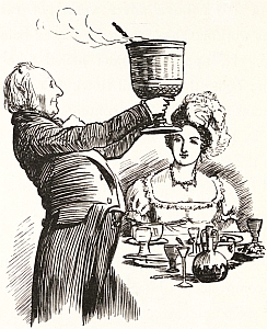
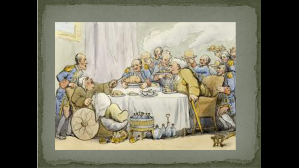
The drinks of choice were: port. Then brandy, claret, punch, rum, porter. So says my source Henry Jeffreys in his book ‘Empire of Booze’ and in this Guardian article:
Claret, probably, originally outsold port. But the wars against France and the difficulty of importing French wine, saw a transfer to wines from our ‘oldest ally’ Portugal. But the travel distance was longer, so the wine was fortified to help preserve it better. Hence, the British addiction to port. Sherry was also popular for similar reasons, being a fortified white wine. Shakespeare calls it ‘sack’ and sometimes ‘Canary’. (Toby Belch ‘says thou lack’st a cup of canary ‘ in ‘Twelfth Night’, which is a Christmas play.)
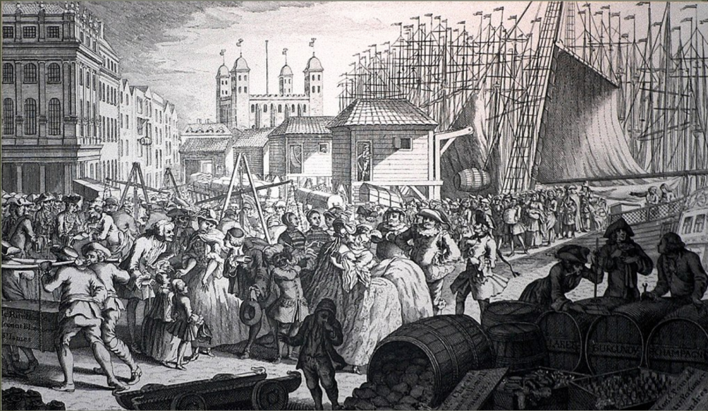
Louis Philippe Boitard‘s satirical engraving ‘Imports from France’ Looking east towards the Tower of London. Barrels at the front right are marked Claret, Burgundy and Champagne.
Consumption was prodigious. Samuel Johnson said, ‘All the decent people in Lichfield (where Johnson came from) got drunk every night and were not the worst thought of’. The Prime Minister. William Pitt the Younger said, ‘I have drunk three bottles of port without being the worst for it. University College has witnessed this.’ He is referring to his college at Oxford University, and so he might be considered to be another of our Prime Ministers who have disgraced themselves at Oxbridge only to rise to rule the unfortunate British. However, in those days, Port was sold in pint measures (45cl) and was 16%, while now it is 20% and sold in 75cl bottles.
Even so, three bottles is still a lot and a drunken population would have not only increased the death rate but also increased violence and abuse. Gout was one result of too much drinking and a rich diet.
Gout. 18th Century Bath
However, this is Christmas so let’s end on a high note, so here are a couple of recipes!
To make ye best punch
“Put 1½ a pound of sugar in a quart of water, stir it well yn put in a pint of Brandy, a quarter of a pint of Lime Juice, & a nutmeg grated, yn put in yr tosts or Biskets well toasted.”
And Gin? While by the 1770s the fear of the effects of cheap gin had ceased to be hot news, and after no less that eight Gin Acts of Parliament to control misuse, its cheapness was not such a threat to an ordered society. Booths and Gordon’s Gins were established in London during this period.
There seems to be a shortage of Gin punch recipes for the 18th Century, but by the end of that century this recipe survives from London’s Garrick Club
– half a pint of gin, lemon peel, lemon juice, sugar, maraschino, a pint and a quarter of water and two bottles of iced soda water.
You would not need many of these to become quite relaxed quite quickly!
Here are some fascinating links with a seasonal theme, and at the end of the post the December posts I have reviewed, revised and reposted. And to remind you, I have a Winter Solstice Virtual Tour on Friday, and a Jane Austen Virtual Tour taking place on Saturday.. Follow the links on the www.chr.org.uk to find out more or book.
The wintery landscapes of Utagawa Hiroshige | with Alfred Haft |
This is a short video of an event held for British Museum members. It’s on YouTube, so it should be available for non-members. It shows, with some animation, beautiful snowy landscapes by the great Hiroshige. It is 12 minutes long.
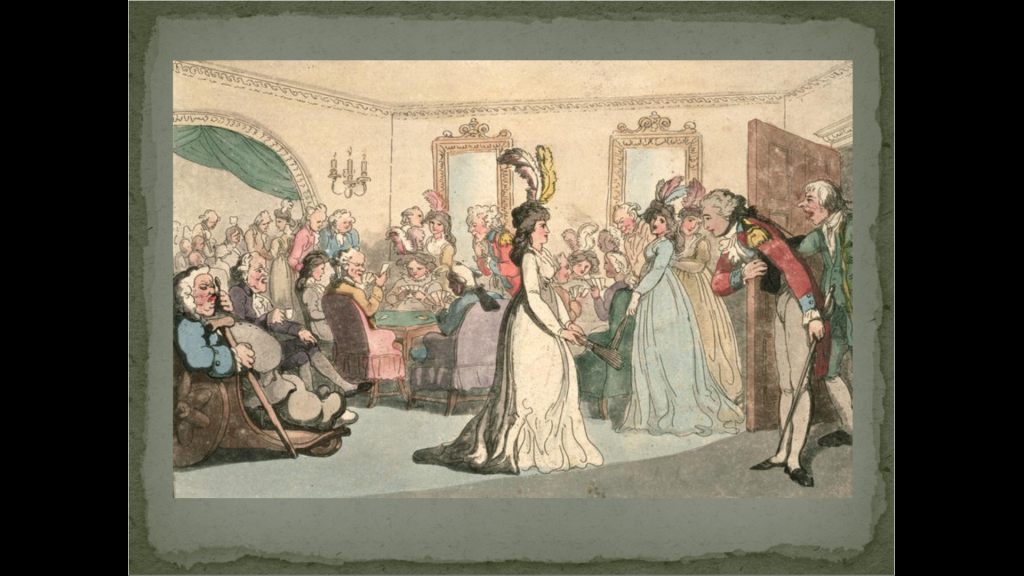
Santa Claus’ Elitist Origins
I came across Ben Tumin’s conversation with Professor Stephen Nissenbaum on Santa Claus’ Elitist Origins in Tumin’s Skipped History Substack posts. Nissebnaum wrote a highly rated book called the ‘Battle for Christmas’, which pointed out that, before the 19th Century, Christmas was largely outdoors, and a riotous time of debauchery, gluttony, and drunkenness. The ruling classes managed in the 19th Century to change this for a quieter, indoor, family-based experience. Well worth a listen.
1811 to 1812 Fanny Austen Knight writing to a friend, Miss Dorothy Chapman
Fanny was the daughter of Jane Austen’s rich brother Edward.
I don’t know whether I told you that Ms Morris’s are at home for the Christmas holidays. They are very nice girls and have contributed a good deal to our entertainment. None of us caught the whooping cough and have been very well the whole time. We have, in general, had cards, snapdragons, bullet pudding etc on any particular evening and Whist, Commerce and others and tickets with the favourite games. I think when cards fail the boys played every evening at draughts, chess, and backgammon.
Commerce is a three card poker type game played with counters. Tickets was Lydia Bennett’s favourite game, which is a gambling game based on luck, and in Pride and Prejudice called ‘Lottery Tickets.’
Bullet Pudding is explained by Fanny in another letter
‘You must have a large pewter dish filled with flour which you must pile up into a sort of pudding with a peak at the top, you must then lay a Bullet at the top & everybody cuts a slice of it & the person who is cutting it when the Bullet falls must poke about with their noise & chins until they find it & then take it out with their mouths which makes them strange figures all covered with flour, but the worst is that you must not laugh for fear of the flour getting up your nose & mouth & choking you. You must not use your hands in taking the bullet out.’
Snapdragons is a lively game, you put some brandy in a tray or flat dish, add a few raisins, light the brandy and the game is to pick up and eat the raisins without getting burnt!
Other games mentioned by Fanny
Hunt the Slipper, Oranges and Lemons, Wind the Jack; Lighting a Candle in Haste; Spare Old Noll.
Coming Very Soon Jane Austen Real and Virtual Walks:
CHRISTMAS & JANE AUSTEN’S LONDON WALK
Jane Austen’s London Walk
Jane Austen’s London Walk
a Special Christmas version on 23 December 2023 & normal one on 21st January
Sat 2.30 pm Green Park underground station, London (By the Fountain, just outside the Green Park exit of the Tube Station)
We explore London’s History through its celebrations, festivals, calendars, and almanacs of the Winter Solstice
Winter Solstice festivals have been a time of review, renewal, and anticipation of the future from time immemorial. The Ancient Britons saw the Solstice as a symbol of a promise of renewal as the world entered bleak mid-winter. The Roman season was presided over by Janus, a two headed God who looked both backwards and forwards, and Dickens based his second great Christmas Book on the renewal that the New Year encouraged.
We look at London’s past to see where and how the Solstice might have been celebrated. We also explore the different Calendars – the Pagan year, the Christian year, the Roman year, the Jewish year, the Financial year, the Academic year, and we reveal how these began. We look at folk traditions, Medieval Christmas Festivals, Boy Bishops, Distaff Sunday and Plough Monday, and other London winter traditions and folklore.
At the end, we use ancient methods to divine what is in store for us in 2023.