Digital Heritage. Town Exploration. Virtual Amsterdam

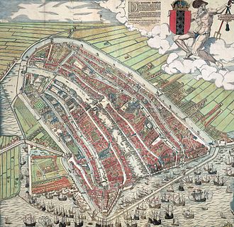
You may have been following my ramblings on my attempts to work out Amsterdam’s history from maps and tramping the streets. But you might want to find out more about the History of Amsterdam from your armchair. So, this is my exploration of virtual Amsterdam. But bear in mind the ideas here can be used in any town exploration.

But if you have only a little time, here are my best tips for exploring Amsterdam online.

First, below is a very good 15 minute introduction to Amsterdam history on YouTube.

Try this Google Earth satellite view of Amsterdam and have fun exploring! Then put your feet up and explore the Van Gogh collection in all its excellent online glory.

But if you have a little more time, lets look at the options as to how the Internet can help you discover Amsterdam.

Online Encyclopedias

Wikipediahttps://en.wikipedia.org/wiki/Amsterdam

Encyclopedia Britannica | Britannica – https://www.britannica.com/place/Amsterdam

I quite often edit Wikipedia pages when I come across entries which are out of date or wrong. The quality of information can be variable but mostly its good. And reading the Amsterdam Page, as long as you are prepared to follow up some of the hypertext links, such as to the ‘Canals of Amsterdam’ or the ‘Defence Line of Amsterdam’ you can get a good idea of the history. But Wikipedia, however great for humanity, is none-the-less aspiring to be an encyclopedia, and not either literature, travel-writing, non-fiction nor entertainment. It is certainly not a virtual tour, and it takes quite a lot of timeto get a good overview of the City and it is not really something I ever do for ‘enjoyment’.

Encyclopedia Britannica has been published exclusively online since 2016 and it is a better read than Wikipedia, less rambling and more to the point. Definitely a better starting point, but still a long read, and, again, something I can’t remember reading with pleasure.

YouTube

There are a number of video lectures/talks/tours on YouTube for free and I will just mention a few – please let me know if you find anything else interesting and I will add it here.

I’ve already linked to the 15 minute ‘A Quick History of Amsterdam (That Dam Guide), which is well put together and gives a good summary. Not enough about the walls in my opinion, and probably a little too much about the major drivers of historical change and not enough about the specific details of what made Amsterdam the town. That is probably asking too much for a 15 minute introduction. And, in effect, this guide is an advert for ‘That Dam Guide’ and the author’s guided virtual tours. He does live streamed 1 hour Amsterdam Tours (none on in March) Very good production values too.

Searching for ‘Amsterdam Virtual Tour’ brings me to the: The Amsterdam Drone Tour which gives a largely drone-eye view of Amsterdam, with slightly annoying music and not enough captions to really feel you are getting to know streets, areas and districts, but it does give an interesting ‘overview’. It is 9 minutes long.

A Free Virtual Tours Amsterdam is an interesting intro to Amsterdam in two 5 minute videos. It does give you some more of, what I would call, ‘structural’ analysis of the history and development of Holland/Amsterdam. It is, to an extent, complimentary to ‘That Dam Guide’. I should not be mentioning it as the ‘Free Walks’ groups are deadly rivals to ‘London Walks’, who I do my walks for. We have a fixed fee for a professional guide, while the Free Walks say they are free but put a lot of pressure on to get customers to pay up a reasonable amount (or so we think!).

Another ‘Tips based’ guide on YouTube is Tim, who gives a 20 minute free walking tour. This one is more of a real virtual walk, as it is a filmed guided walk, with all its imperfections. But, very good in terms of authenticity.

Google Earth

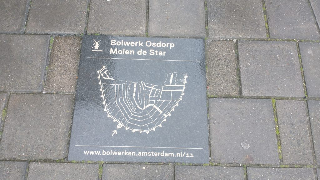
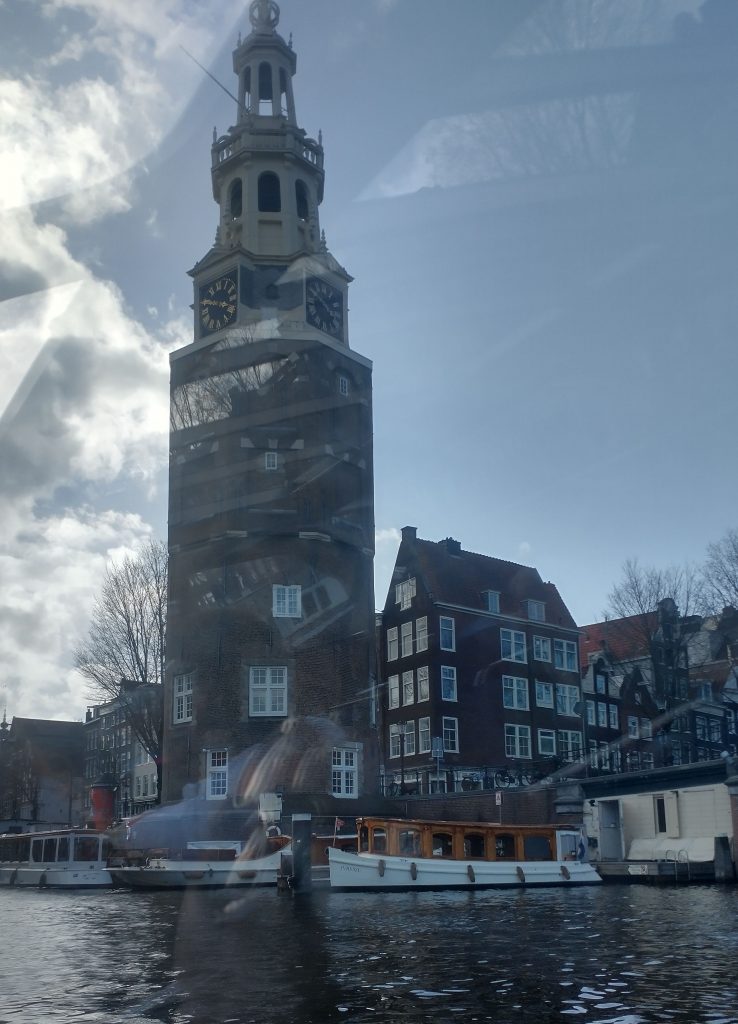
This uses the Google Earth satellite view of Amsterdam, with pins marking many, but by no means all, places of interest. Each place has a little information, and often, a link to Wikipedia. Clicking on the ‘more information’ tab brings up further, and sometimes an extensive number of pictures. There is also a paper aeroplane tab, and this brings up a virtual fly-past which is fun. I was looking for a tab for the Waag, which is one of the remaining gates of old Amsterdam, but I cannot find a tab for it. Nor a search button, which hinders the usefulness of the system. But it is definitely fun!

I have just gone back to Google Earth, found the search icon on the left of the screen, overflown my house, and then searched for the Waag, which I found and here it is! Follow the link to do the fly-past.

Google Earth view of the Waag, City Gate, Dissection Theatre, and now a Restaurant.
My house, on google-earth, to the south of the Canal is a strip of Grass, I live at the extreme left of that strip of grass.

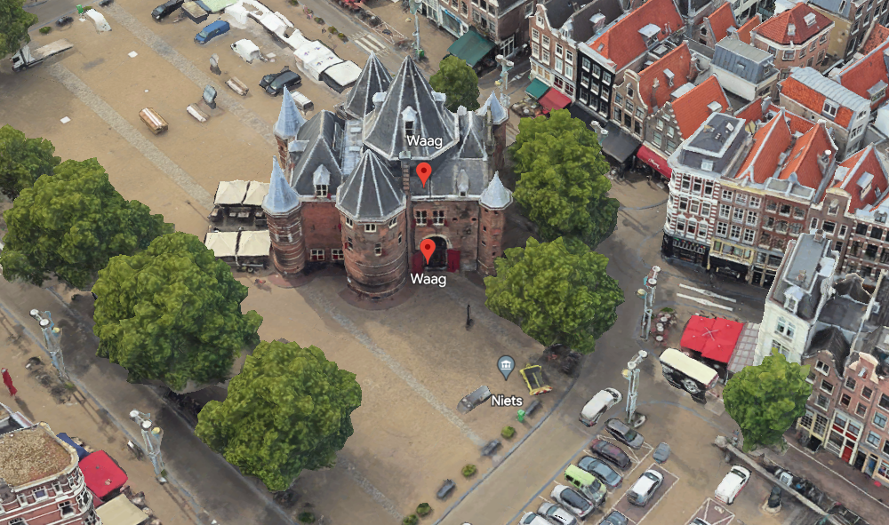
I would definitely use this to explore, and, if I were to be giving a guided tour of Amsterdam I would, indeed, use it in advance to consolidate my knowledge. It has the advantage that it brings to your attention things you would otherwise not know about, and gives a really clear idea of what the place is and what its environment looks like. For example it brought to my attention the houseboat museum, which is now on my must-see bucket list, previously unknown to me.

By the way, I found the Google Earth tour on this blog: www.asthebirdfliesblog.com which has other interesting tips for exploring virtual Amsterdam.

Guided Walks Apps

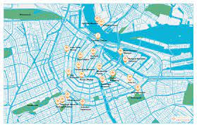
I thought these didn’t really count as they are designed to give a smart-phone based on location walking tour and not an armchair guide. GPSmycity.com is linked to GPS and the user can either access other people’s guided walks, or create their own. I tried it out in Stratford-on-Avon and found it remarkably easy to do. You find the places you want on the tour, and the app ‘sucks in’ the data and pictures from Wikipedia. So within a few minutes you have, a credible, guided tour and a GPS route around the City. In fact, I found it most useful just for creating my own walking routes – much easier than Google, or CityMapper, Just put in the stops and soon your SmartPhone will be dictating your route to you!

But you don’t have to access it via an app, in fact, if you are not going to Amsterdam, its better to visit the web site, and you can go to this link gpsmycity.com, scroll down and you will see a map, and the text for all the stops on the tour. Quite a good introduction, although not inspired. (Its possible you might need to login but I’m not sure as I do have a login.)

Another example is izi-travel, but this provides free and paid for audio guides. Again designed for a smart-phone app to guide around the location, but it can also be accessed on a computer at home. So here is the link to the Amsterdam tour – there are several to choose from.

I would definitely use gpsmycity on tour – I didn’t because I dropped my phone in the oily bilge of my boat, and it went insane for about 2 hours, and reset a lot of my settings, and deleted a few of my apps, including gpsmycity, before deciding to stage a recovery. Izi-travel I have had loaded for several years, and never used, but now listening to it I might have used it like a radio show to introduce me to Amsterdam. I’m also wondering about making my very many guided walks into virtual guided walks on apps like this.

Museum On Line Tours

The Amsterdam Museum should be the museum I would be pointing to for a great on line tour about Amsterdam’s History but it has a temporary Web Site while it works on opening a new Museum. The web has interesting stuff on it, and has the collection online, but nothing that pulls it together like an exhibition, or really gives you much of an introduction to the history of Amsterdam which is very disappointing.

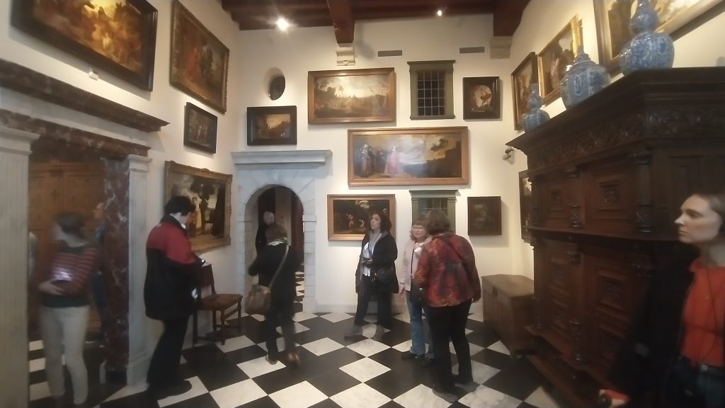
The Van Gogh Museum, by contrast, has an excellent online collection which can be seen, as if a virtual exhibition. But this is much easier for an art museum than a history museum, for two main reasons: the art works are more immediately visually appealing that many objects in Museum Collections which often require context to understand; and art collections are much smaller than history museum collections and so easier to see as a ‘tour’.

Summary

There is nothing to beat walking around a City in the real world. There is nothing, yet, that even comes close to it. Smart Phone tours offer an easy way to tour the physical city, but its difficult to find content on line which provides a really enjoyable armchair online substitute.

The way I explore a City, after finding the walls of course(!), is to read a good guide book. Then buy a good non-fiction history of the city, and search the second hand bookshops for histories/guides/maps and that very special book that noone has heard of and no one knows about which gives unique insights/information that a good guided tour needs. Finally, I try to read a famous novel set in the City, or if in need of light relief, find a local fictional detective.

Podcasts, and ChatGBT also need to be explored.

Remember, if you want more Amsterdam to explore visit here: www.asthebirdfliesblog.com

Town Exploration Amsterdam 3 Making sense of the Canals & Defenses

Plan of Amsterdam Wall Circuit

So, I have built up a story of a Medieval City Wall of Amsterdam with a moat around it and the Amstell flowing through the middle. In the 17th Century the defenses are developed and a set of concentric canals are built.

You can see the details in the schematic plan above. Defensive circuit around the outside, concentric circles of canals inside. The first doubt came to my mind when the pilot of the tourist boat we took around the canals said the concentric rings were built up outwards progressively from the 13th Century onwards.

So, this must mean the original circuit was small and the later circuits expanded the size of the City. Just have a look at a modern plan for a moment.

City plan

Therefore, the medieval circuit was the inner concentric ring and the latest 17th Century circuit was the outer ring. So at least two different defensive perimeters. Let’s look back at the earliest plan of Amsterdam.

The oldest view of Amsterdam by Cornelius Antonisz 1538

This shows the City wall, the port on the seafront at the bottom of the painting with the River Amstel running through the middle of the City, and canals running parallel. There is a moot running outside the wall circuit. This moat is not, as I previously thought, the outer circuit as shown on the modern plan, or on the grey plaque. It is, in fact, the inner circuit. I’ve just looked it up and the moat is called the Singel, originally called the Stedegracht (“City Canal”).

Look at the Google map. The inner blue circuit is the Singel, the original moat and medieval defensive wall. The word Amsterdam is written above where the Singel meets the Amstell. The outer circuit is the 17th Century defensive circuit. You’ll see the icon of Rijksmuseum on this outer canal.

Google Map of the Hiatoric Centre 0f Amsterdarm

Now, a bit of research shows that the Pilot on the boat was repeating an old tale that the canals were progressively expanded from the medieval period onwards. He suggested that as Amsterdam grew it built itself another circuit of canals. But wikipedia assures me this is wrong. What happened was that Amsterdam became so overcrowded in the 17th Century that the authorities had to do something and what they decided to do was to enlarge the City and built a grid of concentric canals linked by linear canals, with an outer circuit of defensive bastions. surrounded by a final concentric canal. The main engine of development was commercial success followed by massive immigration. Its an amazing story of foresight. It meant that Amsterdam’s merchants could all enjoy direct access to goods coming by river and sea, or to shipping if they were exporting.

Each merchant had a tall thin warehouse/workshop of 5 to 7 stories high with a gable with a pole built into it for a pulley to lift goods up from the barges moored outside the merchants house. These houses are mostly of brick although the richest have the trappings of classical columns, and staircases leading up to the first floor. And Amsterdam also had the foresight to keep these merchants houses, and not knock them down. So a large percentage of the centrum of the City is still made up of these brick merchants houses. In the prestigious areas they are banks and offices, elsewhere shops, and houses.

This is a defensive tower on the medieval circuit

Defensive tower on the Medieval Defensive Circuit

I’m not sure if this insight into my working process is enjoyable or not. Its something I have always done because for many years I have enjoyed leading guided walks, and cultural study tours around historic towns in the UK and Europe. In order to feel confident about the tour I have to feel I know the City, and how it articulates, and developed through time. Often it isn’t just a case of reading a guide book or wikipedia. It needs quite a lot of work to understand what is happening are what are the structural elements that led to the City as we see it today. I doubt for example, I would have realised that the Pilot was wrong, had I not had an image of the 16th Century City in my mind to compare with what he was saying.

Another 16th Century view of the original core of the town (by Cornelis Antonisz

Town Exploration Amsterdam 2 Finding the Walls!

Amsterdam City Wall photo K. Flude

Oh! A glorious find! As I said yesterday, I wasn’t sure there was going to be a wall.  But I headed towards the outer of the concentric rings of canals, thinking this is where a defense would be.  I almost went straight to the centre but decided I had to give it a try so walked around the inner side of the outer canal.  And almost immediately I found this slab of ruin.

The Wall!  I thought but was it?  And there was a panel with a plan.

Plan of Amsterdam Wall Circuit

The panel links to this Dutch language site which seems to say in 1663 Amsterdam was given a 5 metre high City Wall.  It talks about 5 sided ‘bolwerken’ which are bastions designed to withstand cannon fire.  And this bit of the wall is near the Osdorp bolwerk.

https://www.amsterdam.nl/kunst-cultuur/monumenten/gebouwen-gebieden/bolwerken-amsterdam/

I then met my daughter and we went to the Rembrandt House which was interesting but very heavily reconstructed and in part difficult to know what was original and what a reconstruction.

Rembrandt House, Amsterdam. Photo K.Flude

In the display was a Rembrandt Etching which features a section of the City Wall and a Windmill.  It is dated to 1641 and so it suggests the 1663 date is for the bolwerken not the wall circuit as such.

The Windmill Rembrandt 1641

The mill was called the Little Stink Mill because it was used in the smelly process of making chamois leather.

There was a plan of the city in Rembrandt’s day but difficult to photo. Our next stop was the Amsterdam Museum which I had insisted we visited to find out information about the history of the City

The oldest view of Amsterdam by Cornelius Antonisz 1538

This shows the City wall with bastions, the port on the seafront at the bottom of the painting with the River Amstel running through the middle of the City, and canals running parallel. There is a moat running outside the wall circuit. What is missing is the concentric ring of canals which now exist inside the wall circuit.

Just to remind you of the current city plan.

City plan

This needs to be turned upside down to match the 16th Century view. A panel in the museum’s notes that Amsterdam is first documented in the late Thirteenth Century. The Protestant Netherlands broke away from the Catholic Hapsburghs in the 16th Century. I’m guessing the walls were built in the late 15th or early 16th Century as the one section I’ve seen is of brick.

So, now I’ve been doing a little research after returning from a visit to the sobering Anne Frank Museum – please remember to challenge prejudice whenever it raises its ugly head. Amsterdam was able to develop into a major town, when a flood turned the shallow river Ij into a wide waterway that linked the Amstel River to the Zuiderzee and the Ijessel in the 12th Century. This gave access to the sea and to the Rhine. It allowed the draining of the banks of the Amstel and with the building of a dam, gave birth to Amsterdam, the Dam on the River Amstel,

In the medieval period the walls were built and bastions added in the 17th Century. In the 17th Century the concentric canal circuits were built and every area given its canal frontage. Virtually all the buildings on the canals have bars protruding from the gable from which to mount a pulley to transfer goods from barge to warehouse, or vice versa,

Between 1880 and 1920 an amazing new defensive circuit was constructed around Amsterdam, which depended up a shallow flooding of the land. But it soon became obelete but is now a Unesco World Heritage Site.

Oh, and to add to what I said, yesterday, the world’s first Stock Exchange was built in Amsterdam in 1602, the same year the Dutch East India company was founded.

It’s a great City, with lots to enjoy, Big enough to be exciting, small enough to be manageable. Full of cyclists on tall upright bikes, chatting to each other as they cycle. I have seen a lot of cyclists riding with their hands in their pockets or holding an umbrella, and it is the first City I have been terrified of crossing the road because of the bikes who seem to ignore pedestrians and expect them to get out of the way; and the trams that hurtle along.

Town Exploration Amsterdam 1

The Canals of Amsterdam

I’ve relieved of the necessity to search for the Town Walls of Amsterdam without prior research by the fact that I am here to see my daughter who has recently broken her ankle, so she has an excuse for refusing to go on forced forced marches around the City.

I haven’t yet had a good look at a map, but the pattern of Canals circuling the centre is amazing and it seems possible there was no need for walls, when the centre is protected by so many rings of water.

I don’t know much about Amsterdam, but it reminds me of the surprising fact that Holland was a major power in the 17th/18th Century. I discovered this on a visit to Kerala in India where I realised that Portugal had a vast empire which was largely taken over by the Dutch in the 17th Century and then taken over by the British in the 18th Century.

It was one of the major pivots in world history. These three countries were small peripheral seafaring nations of no great importance in Europe until the Age of Discovery. Portugal set up trading systems (perhaps rather systems of exploitation) first down the coast of Africa and then to India and beyond. The Dutch then took over the trading stations and took control of the spice routes. Then the British took over.

Previously the spice routes from the East came through Egypt, Greece, Rome, Carthage and later the Ottoman and the Venetian Empires. This made the Mediterranean the richest place in Europe, both north and southern coasts.

The new ocean routes led to a major shift in power from the Mediterranean to the North Sea, leading to the current situation where the Mediterranean is no longer the centre of the world. Greece, Southern Italy, North Africa now under performing economies. A Roman would find this hard to believe.

Portugal, then Holland followed by Britain rose to the status of world power which would, itself, have been inconceivable before the 16th Century.

Holland was in the perfect geographic position astride the trade routes that lead to the heart of Europe. The entry point was the major river systems around the Rhine/Danube axis including the Rhine, the Scheldt, the Waal, and the Amstel. Antwerp, Rotterdam and Amsterdam developed from regional trading towns to global Cities. They spawned a self confident set of merchants who set the foundations of modern capitalism with foundations in spices and slaves.

Central to this was the Dutch East India Company. The first organisation in Europe where an investor only risked their investment rather than the shirt off their back in the event of bankruptcy. This let the shackles off investment, took money out of gold in the bank vaults and multiplied it around the economy.

But not only did it take away the risks of the consequences of investment the Dutch East India Company, set up in Amsterdam in 1602, was given quasi state power, with the ability to fight wars and impose laws on subject populations. This template was copied by the British East India Company which conquered and ran India, setting the seal for the British Empire and Capitalism.