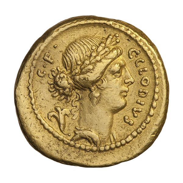
Flora on a gold aureus of 43–39 BC Wikipedia photot by АНО Международный нумизматический клуб
On the 28th of April until the Kalends (15th) of May the Romans, according to Ovid in the ‘Fasti’ Book IV, celebrated the Florialia dedicated to Flora, the Goddess of Spring, flowering, blossoming, budding, planting and fertility. She was one of the 15 Roman Deities offered a state-financed Priest. Her home in Rome, was on the lower slopes of the Aventine Hill near the Circus Maximus.
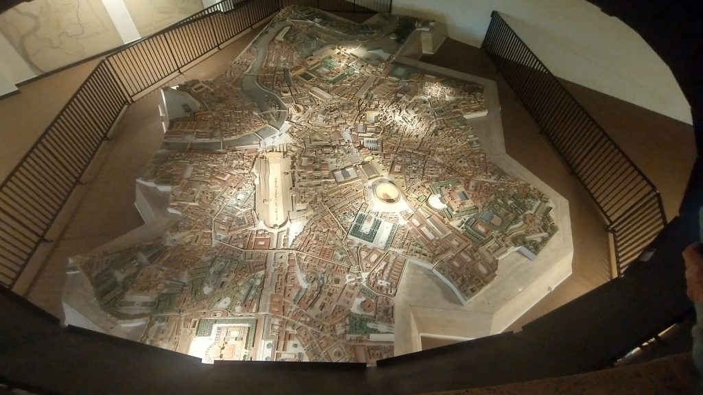
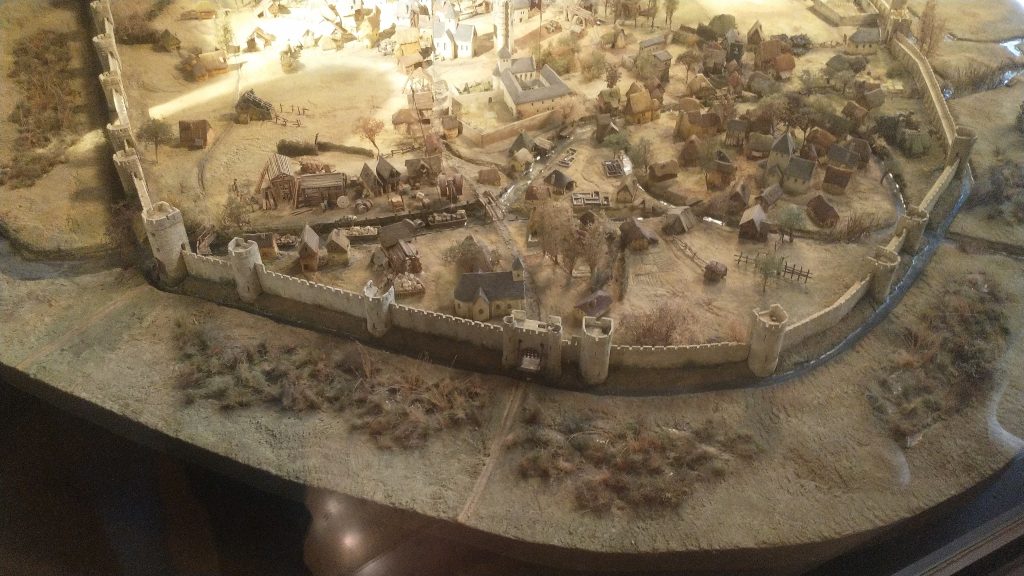
The Circus Maximus is the large long arena in the middle of Rome. Model Musee Arte et Histoire, Brussels, photo Kevin Flude
Celebrations began with theatrical performances, at the end of which the audience were pelted with beans and lupins. Then there were competitive games, and spectacles. The latter, in the reign of Galba, including a tight-rope walking – wait for it – elephant!
Incidently, Galba only survived for 7 months as Emperor – a little longer than Liz Truss’s 44 days but then she was not murdered by a rampaging mob at the end of her reign. It was the year known to history as the year of the 4 Emperors. (great description by Tacitus here:)
Juvenal records that prostitutes were included in the celebration of Flora by dancing naked, and fighting in mock gladiatorial battles. (there is a raging debate about the existence of female gladiators: a burial in Southwark has been said to be one such and Natalie Haynes has her say on the subject here🙂
Hares and goats were released as part of the ceremonies, presumably because they are very fertile and have a ‘salacious’ reputation! (Satyrs were, famously, obsessed with sex and were half man half goat. A man can still be referred to, normally behind his back, as an ‘old goat’).
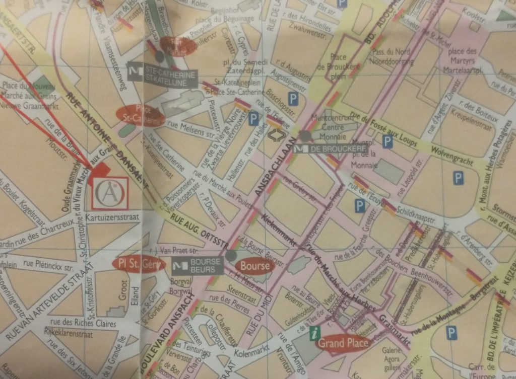
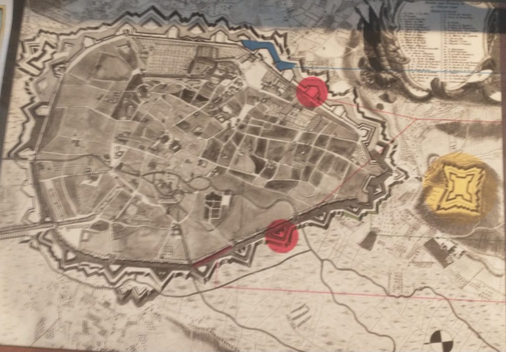
Modern map of central Brussels. The Bourse is a red circle near the centre.
The map of the centre of Brussels shows the area where I have identified topographical evidence of an early Wall circuit. The two red lines coming from the top left point to a red rectangle which is on the curved road called ‘Vieux Marché aux Grains’. This road follows the curved line of the NE section of the wall and was confirmed by the discovery of a surviving section of the Wall on it (see previous posts).
So, on my 4th and last day in Brussels I want to find the rest of this circuit. If you look at the map you can convince yourself there is a circular route – Rue des Riches Clares (Street of the Clare nuns); Rue des Teinturies (Street of Dyers); Kolenmarkt (Coal Market) and to the Grand Place. But I can find nothing that proves it and its a bit weird to have the Town Square (Grand Place) of the town outside the circuit. Maybe this is because the Bourse was the original centre of gravity I wondered? Whatever the case, the roads have the irregularity of medieval town centre streets.
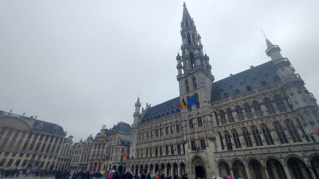
The Town Hall Grand Place, Brussels
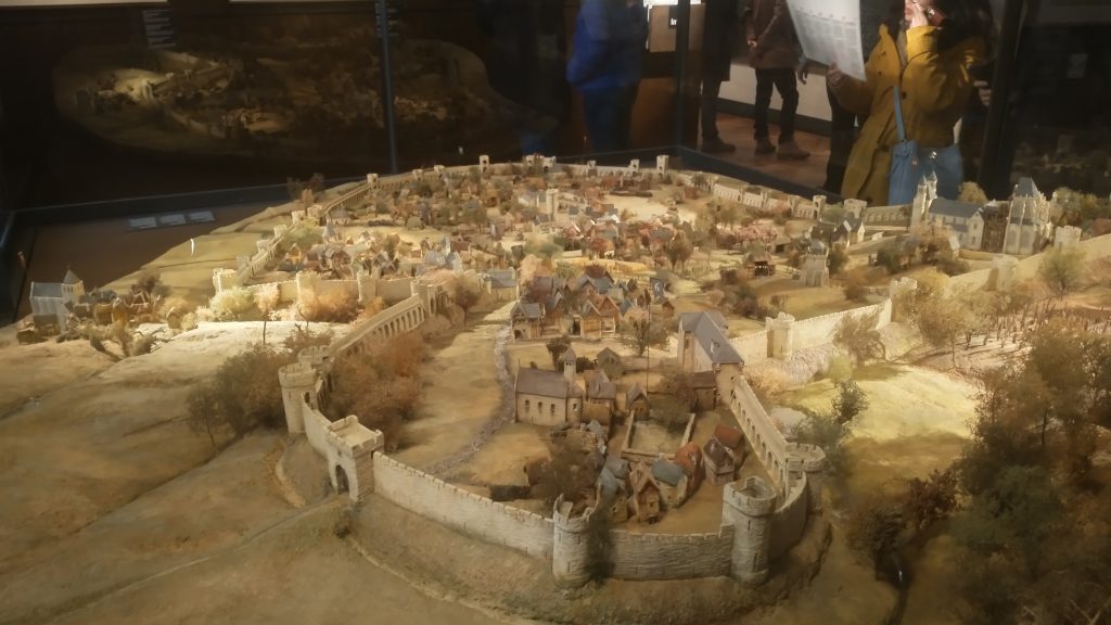
It started to rain so decided to see about a guided tour of the Town Hall, but the attendant suggested I’d be better off at the free ‘House of the King’ across the square which I discover with rising excitement is subtitled ‘The Brussels City Museum.’ Initially I’m disappointed as it is full of fragments of Gothic statues, but upstairs, I strike pay dirt with not only maps, engravings and photographs of the Old Wall Circuit but also a massive model.
Model of 13th Century Wall Circuit of Brussels. (looking South West)
It takes me a lot of time to work out what is what and which direction we are looking. But the section of the wall at the bottom of the photo above is the wall I identified on the Vieux Marché aux Grains. St Catherine’s is the Church seen just inside the Wall, just to the left of the Gate at the middle bottom of the photo. Other evidence makes it clear that the present day St Catherine’s was moved a little to the left (east).
So, a confirmation of sorts, but also a revelation, in that a river is flowing just behind the wall, and the wall circuit is much bigger than I suspected.
The River is the Senne, it was navigable to an extent taking 8 days to take cargoes to the River Schelde. The River is completely gone, and I think the other part of the wall I pencilled in was actually not the wall but roads following the route of the River.
The River Senne, originally the reason for the foundation of Brussels, became a stinking sewer and was filled in leaving no trace, except the roads that ran alongside it or replaced it.
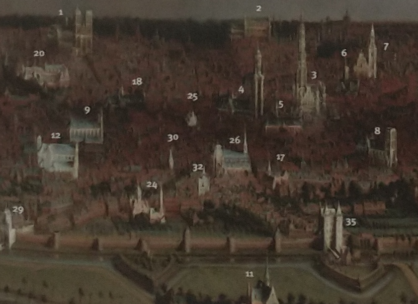
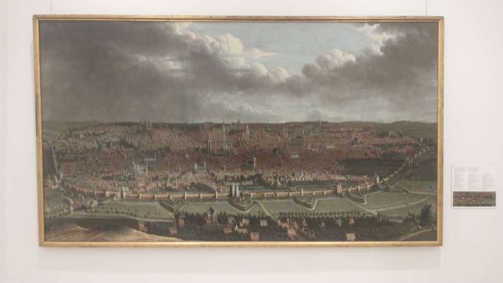
Detail labelled copy of panoramic painting of Brussels c1665 by Jean-Baptiste Bonnercroy. Looking South West
The River was augmented and then replaced by a Canal, which reduced the journey time to the Schelde to one day. The Canal came into the expanded City at no 29 (above_ which is the River gate of the 2nd Wall circuit, and, you might just be able to see a wide street going diagonally from 29 towards no 26, which is St Catherine’s Church. This street used to be the new canal, now a dry linear park and market place.
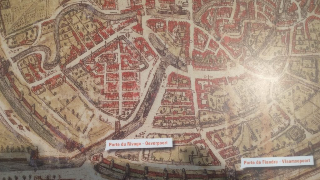
Detail of Braun & Hogenberg map of 1572, showing the canal entering at Porte De Rivage.
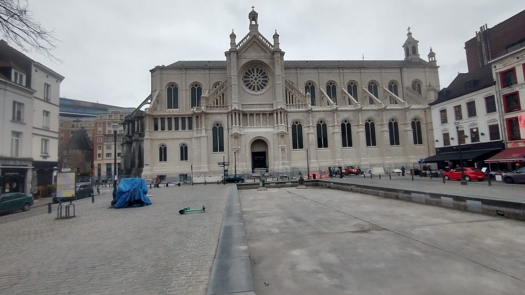
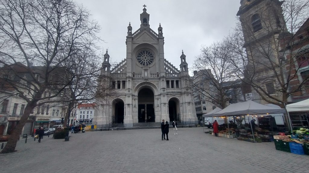
At the end of the canal was a T-Junction so that boats could turn around. When this was filled in and reclaimed St Catherine’s was moved and rebuilt in this space. The Wall was just south of the t-Junction and No 30 in the panorama is the Black Tower, part of the original 13th Century Wall Circuit.
St Catherine’s, built over the old t-junction of the canal. The photo is taken from what was once the canal.
But back to my search for the 13th Century Walk circuit. Look below at the whole model you will see how wrong I was about a small roundish early wall circuit.
Model of 13th Century Wall Circuit of Brussels.
This view of the town is the opposite direction to the previous one, so the wall in the far distance was the section I correctly identified. But I had absolutely no idea that the walled area was so large. The bulge in the wall at the front of the picture was on high ground and was original the site of the Duke of Brabant’s Castle, on Coundenberg Hill and founded in the 11th Century. My exploration was not particularly successful, as far as the 13th Century circuit was concerned, as I had no idea where most of the wall circuit was. I was thinking that there must have been a castle on top of the Hill, but didn’t think the wall circuit would be that big.
Brussels itself began as a small trading town on the River Senne and in the marshy valley of the River. It collected grain from the rich area to export to Antwerp and other urban centres.
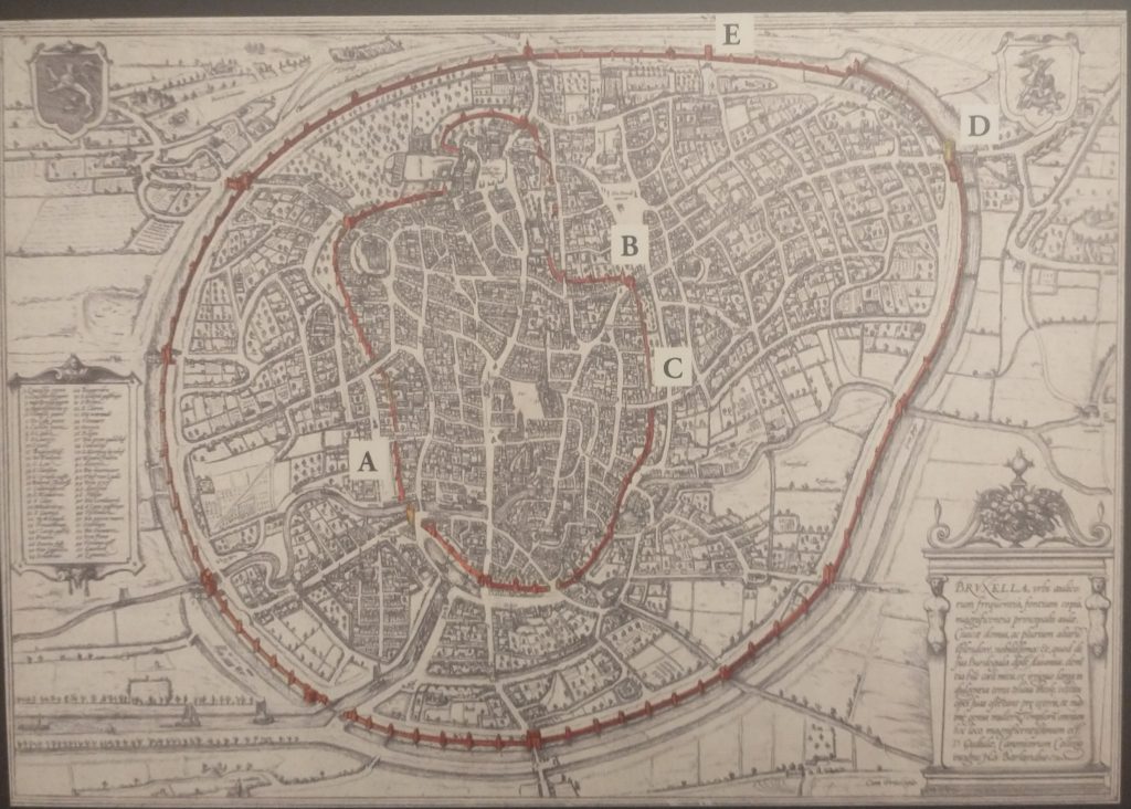
Braun and Hogenberg Plan of Brussels, 1572 showing both wall circuits. North east at the bottom of the plan
The map above shows the two wall circuits. The earliest built 1210 -1230 and the large circuit built in 1357 -1383. That later was extensively developed with the addition of demi-lunettes in 1578, and turned into full bastions in 1671 to cope with the increasing power of artillery. The letters on the plan refer to pictures of the wall that survive.
Panoramic painting of Brussels c1665 by Jean-Baptiste Bonnercroy. Looking South West
The second wall circuit can clearly be seen in the picture above, with Porte de Flandres in the centre, and demi-lunettes in front of the 14th Century Wall.
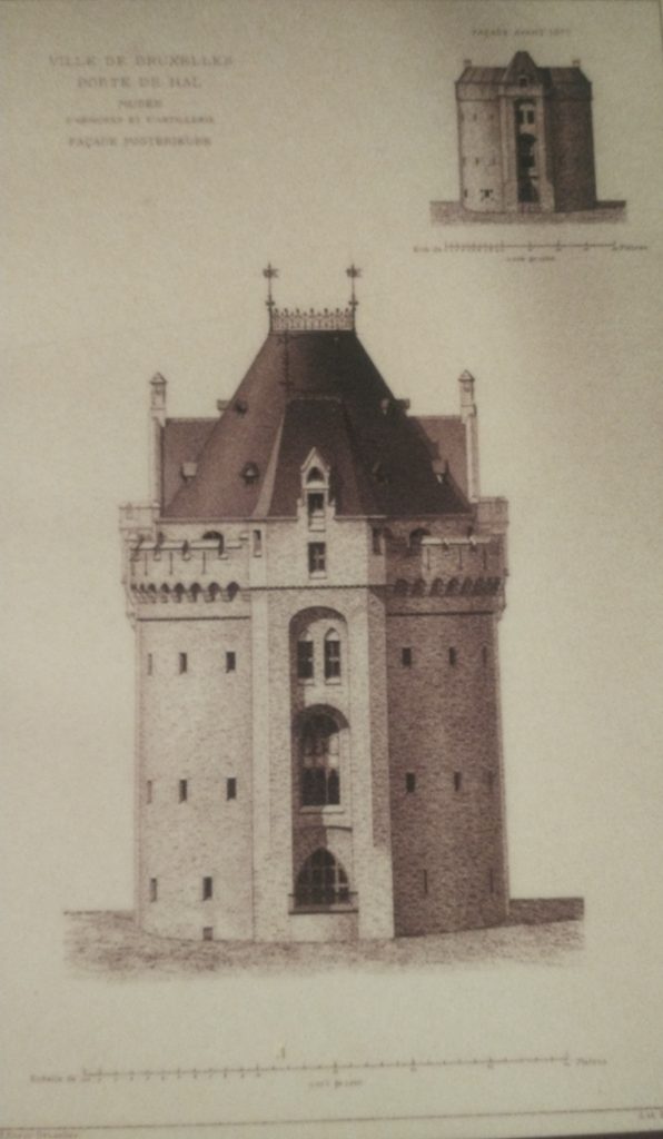
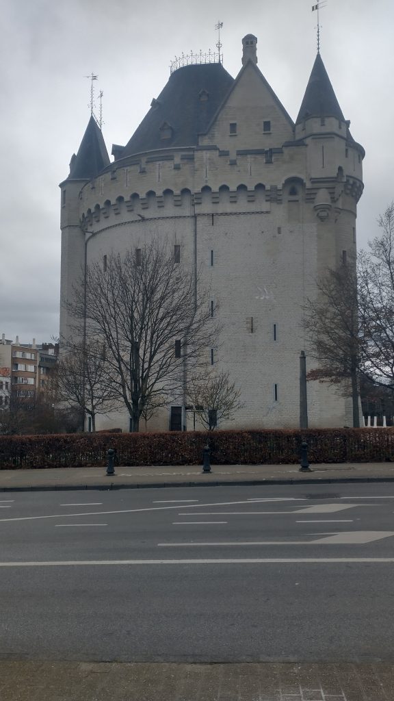
I finished the exploration by finally getting into the 14th Century Gate – Porte de Halle which was wall worth the two trips.
Porte de Halles
This image below will give a good idea of the final form of the defences before they were almost totally demolished and replaced by a ring road.
The late 17th Century Defences of Brussels.
So all in all Brussels is a very interesting City with great museums, amazing pubs/bars, fabulous remains of Art Nouveau dotted around, and an interesting history. As to my exploration, very enjoyable, a little disappointed I didn’t find the River, or identify more of the 13th Century Circuit. With another day I would have walked the entire 13th and 14th Century circuits. But I suspect the surgeon who did my hernia operation would have thought I overdid it as it was.
modern map of central Brussels. The Bourse is a red circle near the centre.
So my next task is to confirm the earlier wall circuit on the map.
To remind you I have tentatively identified the street called the’ Vieux Marché aux Grains’ as a section of an earlier wall circuit surrounding Brussels. On the map above the two red lines coming from the top left point to a red rectangle which is on the Vieux Marché. Walking along it you soon come to a beautiful church dedicated to St Catherine. It must be either just inside, just outside or on top of my walk circuit.
St Catherine’s, Brussels
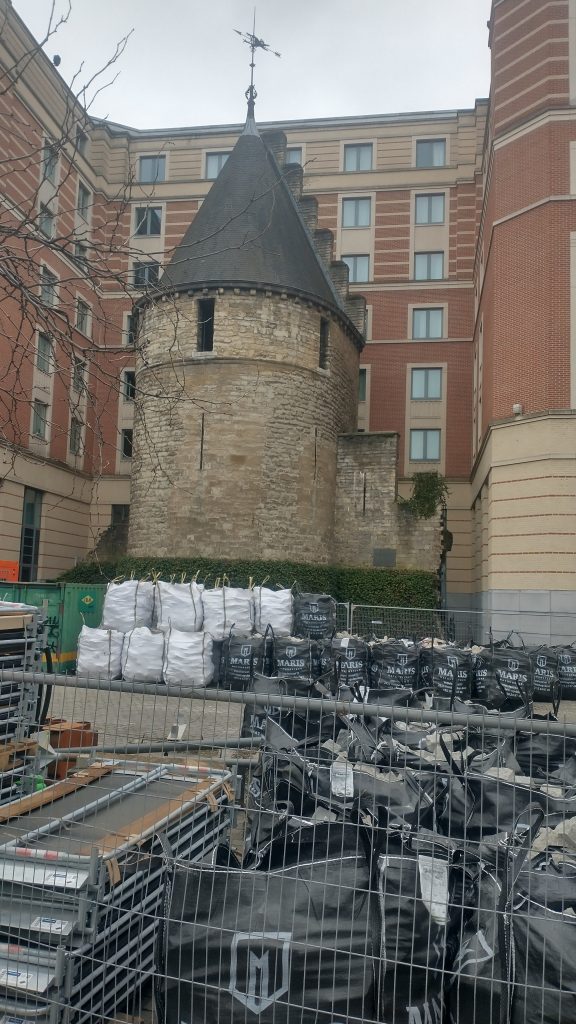
I walk into the church, photograph lots of saints and walk out and there just beyond it is the confirmation that I’m right. There is a beautiful interval Tower and, just to make it certain, it has sections of wall coming out from it. So this the earlier wall circuit. Looks medieval, a century or two earlier than the Porte de Halles.
The Black Tower, Brussels
So, I’m feeling pleased with myself. Two wall circuits confirmed, the outer one I know where the entire circuit is and that it has all been swept away and replaced by an urban ring road except a couple (?) of fragments.
The inner circuit I have only confirmed one section, I know one more bit of it exists or did exist but pretty sure not much else. I’m thinking from the street pattern that it is a small roundish circuit, but nothing is clear from the street pattern apart from this one street.
Feeling smug although I am aware this is a strange game I play with myself. I could just Google ‘Brussels Town Walls’ and I would have most of the answers instantly but the fun of the game is to find it out yourself through topographical clues.
I do it, I think, partly to honour my friend, David Bentley, who died of motor neurone disease a good few years ago but not before we had many stimulating discussions on topographical clues to urban history. Also, it really helps you understand the City, it will tell you why particular roads are important, and give the history of the growth of the town. Since I lost David it is often a solitary game as it needs a very tolerant person to put up with following leads to frequent dead ends and someone who can share the thrill of finding a small fragment of ‘wall’ in exactly the predicted place.
One more discovery before I end. There is a linear ‘park’ coming down from the Porte Flandres, it is lined with what remind me of canalside houses in Bruges, and this seems to be the original route of the canal that was built to link Brussels to the Scheldt. I was told that the canal was diverted when they built the new walk circuit so this seems to be the original course. It comes down to the side of St Catherine’s.
Filled in Canal leading to St Catherine’s. Fish restaurants to the right and you can just see the Black Tower to the left of the Church.
I have no idea how the boats turned around but the grain market was to the right and the fish restaurants suggest this is where fish were landed.
Tomorrow, you will find out if my smugness is confirmed after I decide it is time to check the facts and leave speculation behind.
Panoramic painting of Brussels c1665 by Jean-Baptiste Bonnercoy.
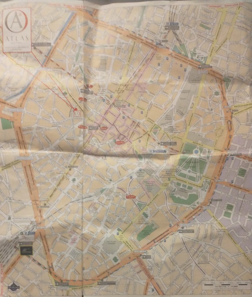
So I arrived at the hotel in Brussels. Got their free map and looked for likely Wall circuits.
Creased Map of Brussels
As you will see there is an extensive inner ring road or boulevard clearly marked in orange. This is, I thought probably the Renaissance wall alignment when the town had expanded and the old walls became useless in the face of cannons.
A closer look at the map confirms it was a wall circuit as at junctions there is a grey label saying ‘Porte de Flandres’ or similar.
So the next task is to find if there was an earlier wall circuit on the map. I’m basically looking for curved roads that were originally just inside the walls or just outside.
modern map of central Brussels. The Bourse is a red circle near the centre.
The two red lines coming from the top left point to a red rectangle which is my hotel and by chance is on a curved road which is my guess to be the early wall circuit. It is called the ‘Vieux Marché aux Grains’. I had a quick explore before retiring for the night. But found nothing conclusive and St Catherine’s Church is astride it.
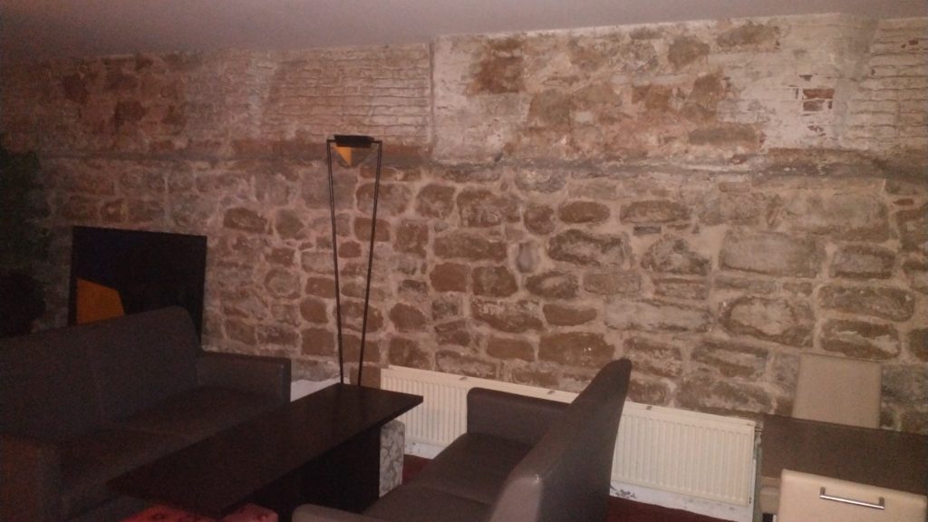
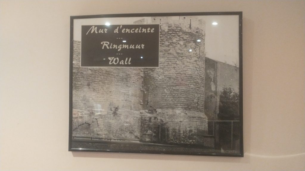
At breakfast, in the basement I failed to notice that 3 of the 4 walls were ancient stone, and there was a picture of a wall and bastion tower. These were pointed out by a staff member, and they suggested they were part of the wall.
Basement cafe of Hotel Atlas
The walls in the basement formed three sides of a rectangle so I had my doubts whether it was ‘the wall’ but it could be a tower or a building built up against the wall. But the picture certainly confirmed my guess that this curved street marked the route of the early wall.
Picture of the wall
So next I walked up to the ‘Porte de Flandres’ in the north east of the town on what I am calling the Renaissance circuit. I wanted to see if any gate or wall survived (no) and to look at the canal which runs alongside the wall.
Then to visit Brussels amazing museums where in the Old Masters museum was found the view of the walls that you will find above. The view is from the north east and at the bottom you will see the canal that linked Brussels to the main trade routes with triangular ramparts in front designed to withstand cannon fire, with the canal and the wall behind. Right in the centre of the bottom is the Porte de Flandres. It looks 15th Century to me, give or take a century but the triangular ramparts look 17th Century.
At the Museum were leaflets to a Porte de Halle museum, So I went from the Musee d’Arte et D’ Histoire, through the European Parliament to the old Wall circuit past several old gates which no longer exist and then saw the view below of the Porte de Halle.
Porte de Halle, Brussels
It looks like something from the Très Riches Heures du Duc de Berry which is early 15th Century. I couldn’t confirm because the gatekeeper of the Porte refused entry as, he said, last entry was at 4pm (1 arrived at 4.03pm) although the leaflet clearly says last entry is 45 mins prior to closing at 5pm.
So I went to confirm the existence of the earlier wall circuit. And I will post about that later.