
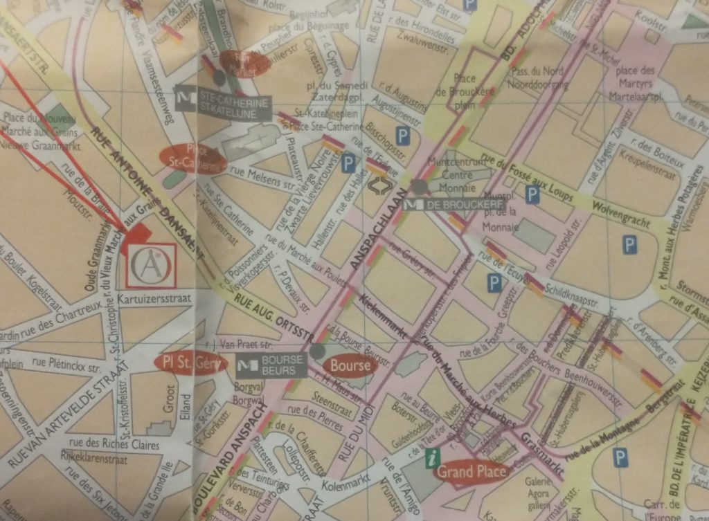
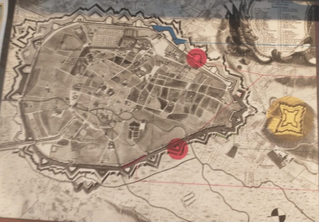
The map of the centre of Brussels shows the area where I have identified topographical evidence of an early Wall circuit. The two red lines coming from the top left point to a red rectangle which is on the curved road called ‘Vieux Marché aux Grains’. This road follows the curved line of the NE section of the wall and was confirmed by the discovery of a surviving section of the Wall on it (see previous posts).
So, on my 4th and last day in Brussels I want to find the rest of this circuit. If you look at the map you can convince yourself there is a circular route – Rue des Riches Clares (Street of the Clare nuns); Rue des Teinturies (Street of Dyers); Kolenmarkt (Coal Market) and to the Grand Place. But I can find nothing that proves it and its a bit weird to have the Town Square (Grand Place) of the town outside the circuit. Maybe this is because the Bourse was the original centre of gravity I wondered? Whatever the case, the roads have the irregularity of medieval town centre streets.
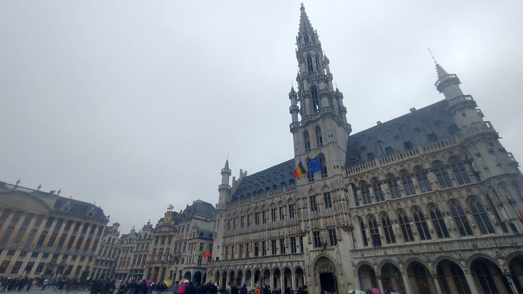
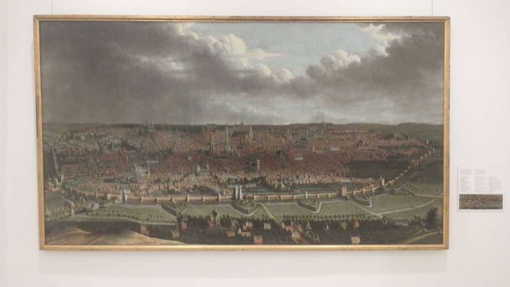
It started to rain so decided to see about a guided tour of the Town Hall, but the attendant suggested I’d be better off at the free ‘House of the King’ across the square which I discover with rising excitement is subtitled ‘The Brussels City Museum.’ Initially I’m disappointed as it is full of fragments of Gothic statues, but upstairs, I strike pay dirt with not only maps, engravings and photographs of the Old Wall Circuit but also a massive model.
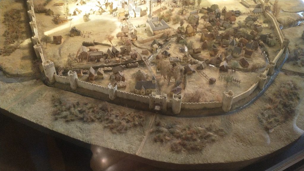
It takes me a lot of time to work out what is what and which direction we are looking. But the section of the wall at the bottom of the photo above is the wall I identified on the Vieux Marché aux Grains. St Catherine’s is the Church seen just inside the Wall, just to the left of the Gate at the middle bottom of the photo. Other evidence makes it clear that the present day St Catherine’s was moved a little to the left (east).
So, a confirmation of sorts, but also a revelation, in that a river is flowing just behind the wall, and the wall circuit is much bigger than I suspected.
The River is the Senne, it was navigable to an extent taking 8 days to take cargoes to the River Schelde. The River is completely gone, and I think the other part of the wall I pencilled in was actually not the wall but roads following the route of the River.
The River Senne, originally the reason for the foundation of Brussels, became a stinking sewer and was filled in leaving no trace, except the roads that ran alongside it or replaced it.
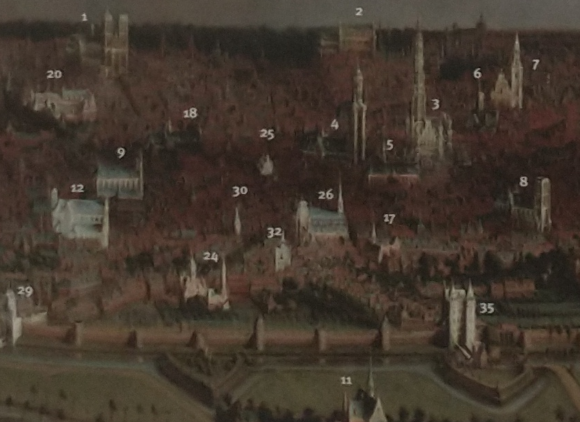
The River was augmented and then replaced by a Canal, which reduced the journey time to the Schelde to one day. The Canal came into the expanded City at no 29 (above_ which is the River gate of the 2nd Wall circuit, and, you might just be able to see a wide street going diagonally from 29 towards no 26, which is St Catherine’s Church. This street used to be the new canal, now a dry linear park and market place.
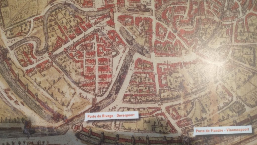
At the end of the canal was a T-Junction so that boats could turn around. When this was filled in and reclaimed St Catherine’s was moved and rebuilt in this space. The Wall was just south of the t-Junction and No 30 in the panorama is the Black Tower, part of the original 13th Century Wall Circuit.
But back to my search for the 13th Century Walk circuit. Look below at the whole model you will see how wrong I was about a small roundish early wall circuit.
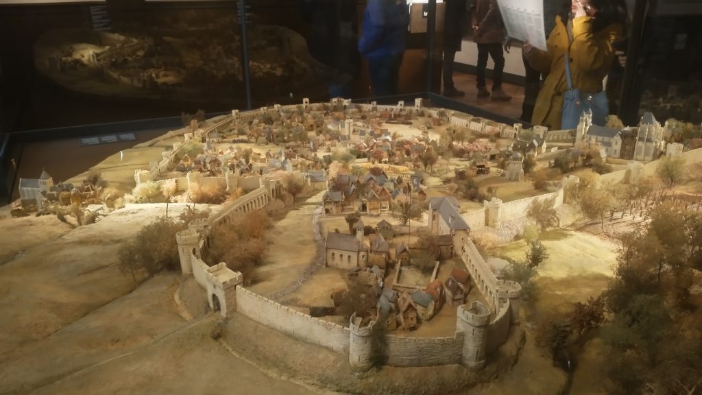
This view of the town is the opposite direction to the previous one, so the wall in the far distance was the section I correctly identified. But I had absolutely no idea that the walled area was so large. The bulge in the wall at the front of the picture was on high ground and was original the site of the Duke of Brabant’s Castle, on Coundenberg Hill and founded in the 11th Century. My exploration was not particularly successful, as far as the 13th Century circuit was concerned, as I had no idea where most of the wall circuit was. I was thinking that there must have been a castle on top of the Hill, but didn’t think the wall circuit would be that big.
Brussels itself began as a small trading town on the River Senne and in the marshy valley of the River. It collected grain from the rich area to export to Antwerp and other urban centres.
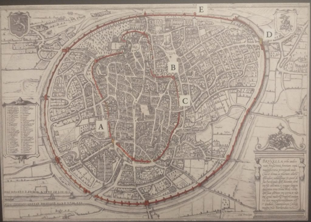
The map above shows the two wall circuits. The earliest built 1210 -1230 and the large circuit built in 1357 -1383. That later was extensively developed with the addition of demi-lunettes in 1578, and turned into full bastions in 1671 to cope with the increasing power of artillery. The letters on the plan refer to pictures of the wall that survive.
The second wall circuit can clearly be seen in the picture above, with Porte de Flandres in the centre, and demi-lunettes in front of the 14th Century Wall.
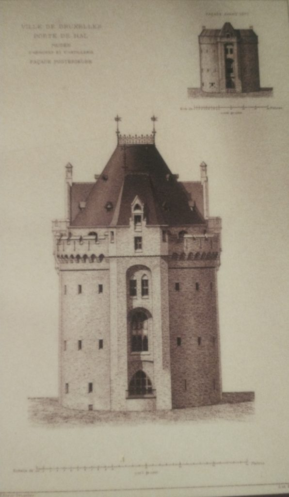
I finished the exploration by finally getting into the 14th Century Gate – Porte de Halle which was wall worth the two trips.
This image below will give a good idea of the final form of the defences before they were almost totally demolished and replaced by a ring road.
So all in all Brussels is a very interesting City with great museums, amazing pubs/bars, fabulous remains of Art Nouveau dotted around, and an interesting history. As to my exploration, very enjoyable, a little disappointed I didn’t find the River, or identify more of the 13th Century Circuit. With another day I would have walked the entire 13th and 14th Century circuits. But I suspect the surgeon who did my hernia operation would have thought I overdid it as it was.
Discover more from And Did Those Feet
Subscribe to get the latest posts sent to your email.