
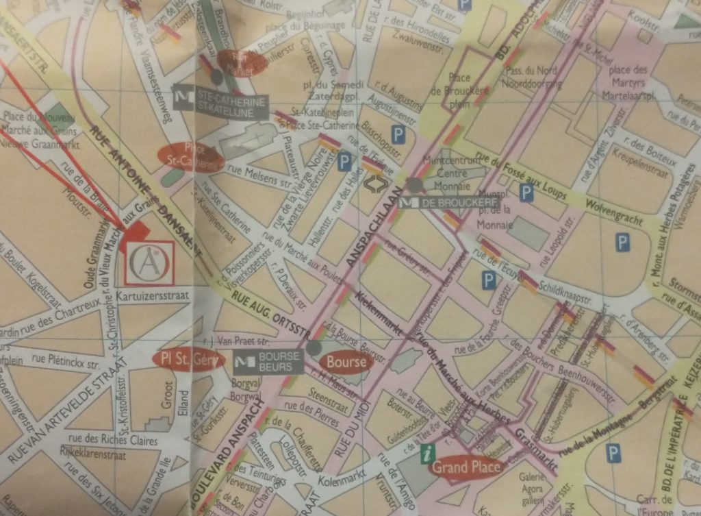
So my next task is to confirm the earlier wall circuit on the map.
To remind you I have tentatively identified the street called the’ Vieux Marché aux Grains’ as a section of an earlier wall circuit surrounding Brussels. On the map above the two red lines coming from the top left point to a red rectangle which is on the Vieux Marché. Walking along it you soon come to a beautiful church dedicated to St Catherine. It must be either just inside, just outside or on top of my walk circuit.
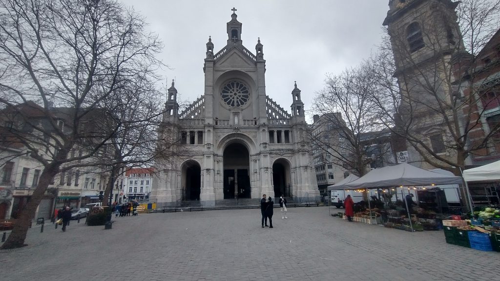
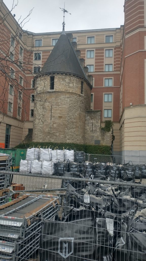
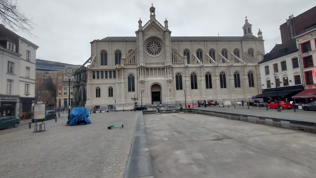
I walk into the church, photograph lots of saints and walk out and there just beyond it is the confirmation that I’m right. There is a beautiful interval Tower and, just to make it certain, it has sections of wall coming out from it. So this the earlier wall circuit. Looks medieval, a century or two earlier than the Porte de Halles.
So, I’m feeling pleased with myself. Two wall circuits confirmed, the outer one I know where the entire circuit is and that it has all been swept away and replaced by an urban ring road except a couple (?) of fragments.
The inner circuit I have only confirmed one section, I know one more bit of it exists or did exist but pretty sure not much else. I’m thinking from the street pattern that it is a small roundish circuit, but nothing is clear from the street pattern apart from this one street.
Feeling smug although I am aware this is a strange game I play with myself. I could just Google ‘Brussels Town Walls’ and I would have most of the answers instantly but the fun of the game is to find it out yourself through topographical clues.
I do it, I think, partly to honour my friend, David Bentley, who died of motor neurone disease a good few years ago but not before we had many stimulating discussions on topographical clues to urban history. Also, it really helps you understand the City, it will tell you why particular roads are important, and give the history of the growth of the town. Since I lost David it is often a solitary game as it needs a very tolerant person to put up with following leads to frequent dead ends and someone who can share the thrill of finding a small fragment of ‘wall’ in exactly the predicted place.
One more discovery before I end. There is a linear ‘park’ coming down from the Porte Flandres, it is lined with what remind me of canalside houses in Bruges, and this seems to be the original route of the canal that was built to link Brussels to the Scheldt. I was told that the canal was diverted when they built the new walk circuit so this seems to be the original course. It comes down to the side of St Catherine’s.
I have no idea how the boats turned around but the grain market was to the right and the fish restaurants suggest this is where fish were landed.
Tomorrow, you will find out if my smugness is confirmed after I decide it is time to check the facts and leave speculation behind.
Discover more from And Did Those Feet
Subscribe to get the latest posts sent to your email.
Great fun, Kevin! Sorry about the loss of your friend.
yes, it is! Terrible disease motor neurone disease.