Town Exploration Amsterdam 3 Making sense of the Canals & Defenses

Plan of Amsterdam Wall Circuit

So, I have built up a story of a Medieval City Wall of Amsterdam with a moat around it and the Amstell flowing through the middle. In the 17th Century the defenses are developed and a set of concentric canals are built.

You can see the details in the schematic plan above. Defensive circuit around the outside, concentric circles of canals inside. The first doubt came to my mind when the pilot of the tourist boat we took around the canals said the concentric rings were built up outwards progressively from the 13th Century onwards.

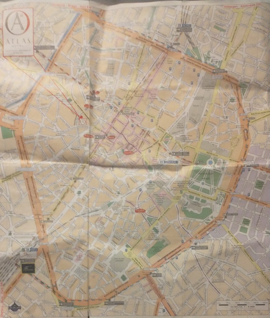
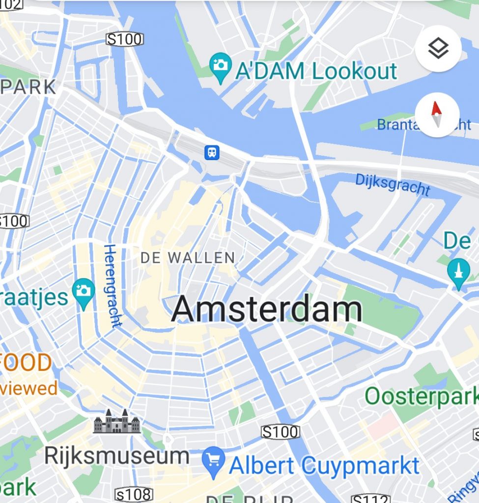
So, this must mean the original circuit was small and the later circuits expanded the size of the City. Just have a look at a modern plan for a moment.

City plan

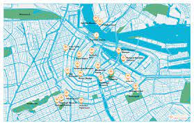
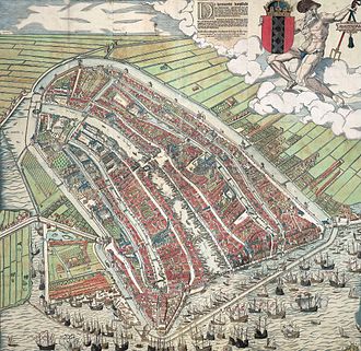
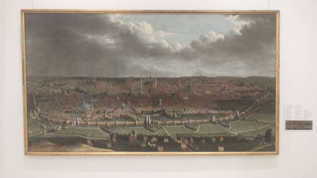
Therefore, the medieval circuit was the inner concentric ring and the latest 17th Century circuit was the outer ring. So at least two different defensive perimeters. Let’s look back at the earliest plan of Amsterdam.

The oldest view of Amsterdam by Cornelius Antonisz 1538

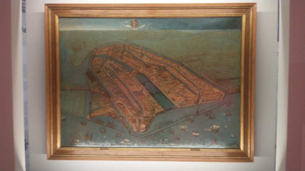
This shows the City wall, the port on the seafront at the bottom of the painting with the River Amstel running through the middle of the City, and canals running parallel. There is a moot running outside the wall circuit. This moat is not, as I previously thought, the outer circuit as shown on the modern plan, or on the grey plaque. It is, in fact, the inner circuit. I’ve just looked it up and the moat is called the Singel, originally called the Stedegracht (“City Canal”).

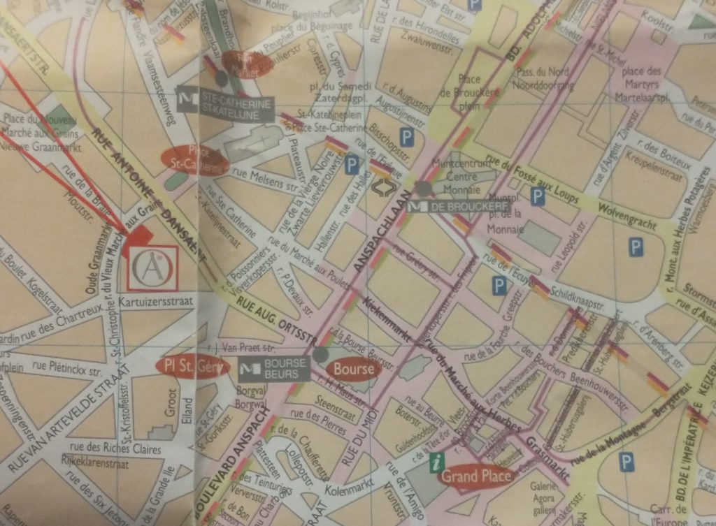
Look at the Google map. The inner blue circuit is the Singel, the original moat and medieval defensive wall. The word Amsterdam is written above where the Singel meets the Amstell. The outer circuit is the 17th Century defensive circuit. You’ll see the icon of Rijksmuseum on this outer canal.

Google Map of the Hiatoric Centre 0f Amsterdarm

Now, a bit of research shows that the Pilot on the boat was repeating an old tale that the canals were progressively expanded from the medieval period onwards. He suggested that as Amsterdam grew it built itself another circuit of canals. But wikipedia assures me this is wrong. What happened was that Amsterdam became so overcrowded in the 17th Century that the authorities had to do something and what they decided to do was to enlarge the City and built a grid of concentric canals linked by linear canals, with an outer circuit of defensive bastions. surrounded by a final concentric canal. The main engine of development was commercial success followed by massive immigration. Its an amazing story of foresight. It meant that Amsterdam’s merchants could all enjoy direct access to goods coming by river and sea, or to shipping if they were exporting.

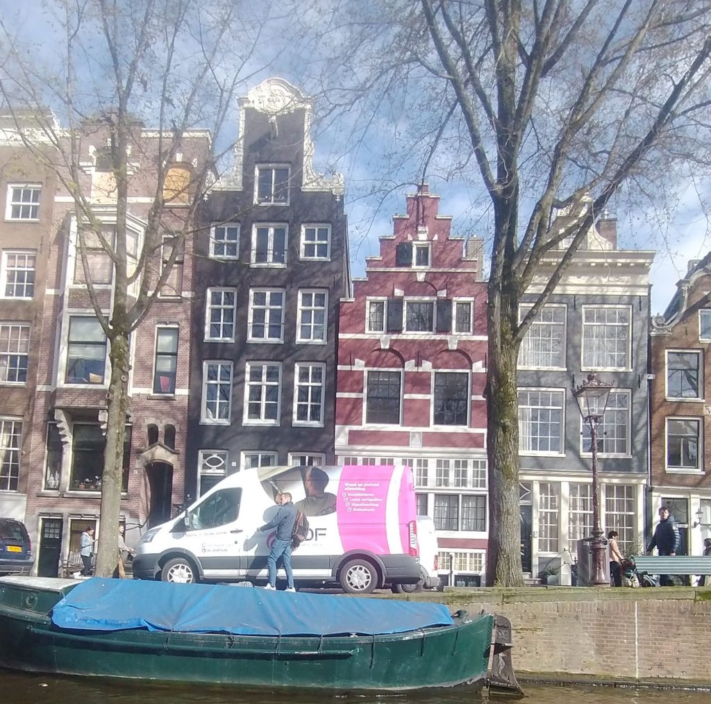
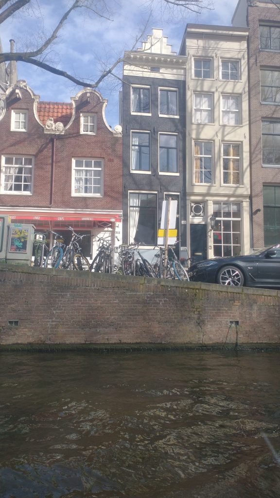
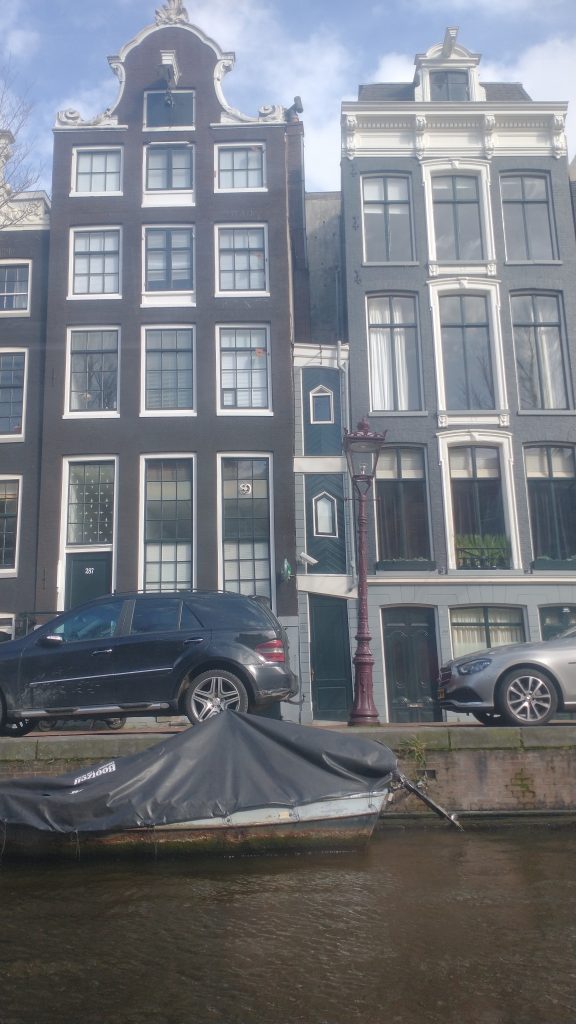
Each merchant had a tall thin warehouse/workshop of 5 to 7 stories high with a gable with a pole built into it for a pulley to lift goods up from the barges moored outside the merchants house. These houses are mostly of brick although the richest have the trappings of classical columns, and staircases leading up to the first floor. And Amsterdam also had the foresight to keep these merchants houses, and not knock them down. So a large percentage of the centrum of the City is still made up of these brick merchants houses. In the prestigious areas they are banks and offices, elsewhere shops, and houses.

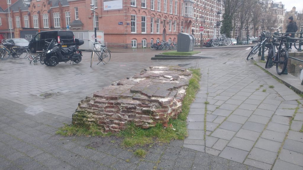
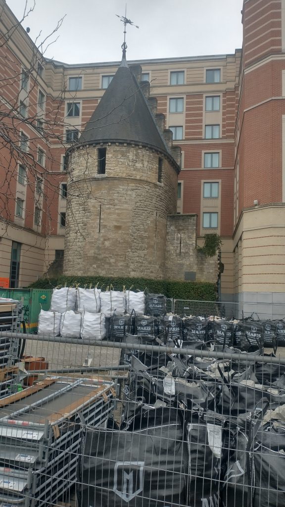
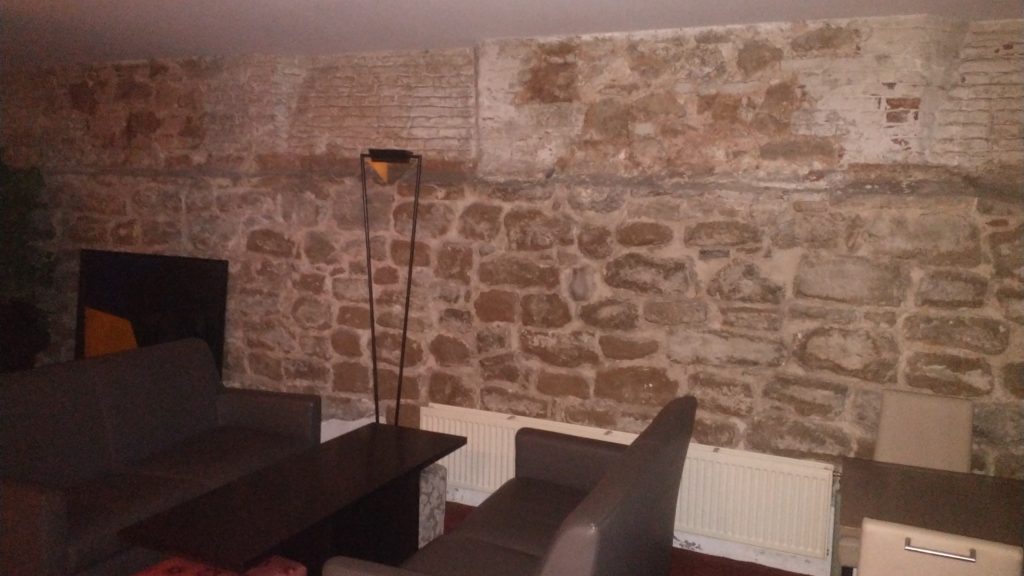
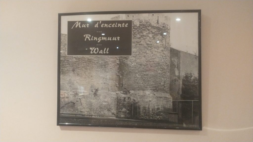
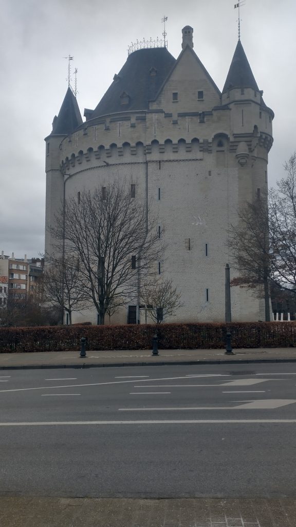
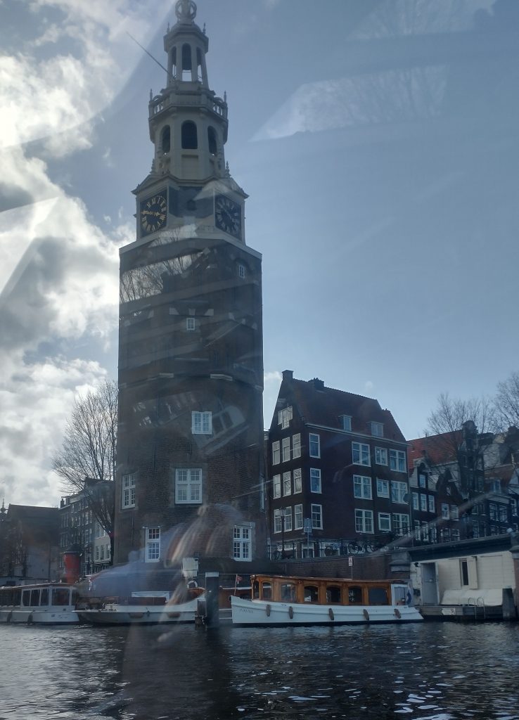
This is a defensive tower on the medieval circuit

Defensive tower on the Medieval Defensive Circuit

I’m not sure if this insight into my working process is enjoyable or not. Its something I have always done because for many years I have enjoyed leading guided walks, and cultural study tours around historic towns in the UK and Europe. In order to feel confident about the tour I have to feel I know the City, and how it articulates, and developed through time. Often it isn’t just a case of reading a guide book or wikipedia. It needs quite a lot of work to understand what is happening are what are the structural elements that led to the City as we see it today. I doubt for example, I would have realised that the Pilot was wrong, had I not had an image of the 16th Century City in my mind to compare with what he was saying.

Another 16th Century view of the original core of the town (by Cornelis Antonisz

Town Exploration Amsterdam 2 Finding the Walls!

Amsterdam City Wall photo K. Flude

Oh! A glorious find! As I said yesterday, I wasn’t sure there was going to be a wall.  But I headed towards the outer of the concentric rings of canals, thinking this is where a defense would be.  I almost went straight to the centre but decided I had to give it a try so walked around the inner side of the outer canal.  And almost immediately I found this slab of ruin.

The Wall!  I thought but was it?  And there was a panel with a plan.

Plan of Amsterdam Wall Circuit

The panel links to this Dutch language site which seems to say in 1663 Amsterdam was given a 5 metre high City Wall.  It talks about 5 sided ‘bolwerken’ which are bastions designed to withstand cannon fire.  And this bit of the wall is near the Osdorp bolwerk.

https://www.amsterdam.nl/kunst-cultuur/monumenten/gebouwen-gebieden/bolwerken-amsterdam/

I then met my daughter and we went to the Rembrandt House which was interesting but very heavily reconstructed and in part difficult to know what was original and what a reconstruction.

Rembrandt House, Amsterdam. Photo K.Flude

In the display was a Rembrandt Etching which features a section of the City Wall and a Windmill.  It is dated to 1641 and so it suggests the 1663 date is for the bolwerken not the wall circuit as such.

The Windmill Rembrandt 1641

The mill was called the Little Stink Mill because it was used in the smelly process of making chamois leather.

There was a plan of the city in Rembrandt’s day but difficult to photo. Our next stop was the Amsterdam Museum which I had insisted we visited to find out information about the history of the City

The oldest view of Amsterdam by Cornelius Antonisz 1538

This shows the City wall with bastions, the port on the seafront at the bottom of the painting with the River Amstel running through the middle of the City, and canals running parallel. There is a moat running outside the wall circuit. What is missing is the concentric ring of canals which now exist inside the wall circuit.

Just to remind you of the current city plan.

City plan

This needs to be turned upside down to match the 16th Century view. A panel in the museum’s notes that Amsterdam is first documented in the late Thirteenth Century. The Protestant Netherlands broke away from the Catholic Hapsburghs in the 16th Century. I’m guessing the walls were built in the late 15th or early 16th Century as the one section I’ve seen is of brick.

So, now I’ve been doing a little research after returning from a visit to the sobering Anne Frank Museum – please remember to challenge prejudice whenever it raises its ugly head. Amsterdam was able to develop into a major town, when a flood turned the shallow river Ij into a wide waterway that linked the Amstel River to the Zuiderzee and the Ijessel in the 12th Century. This gave access to the sea and to the Rhine. It allowed the draining of the banks of the Amstel and with the building of a dam, gave birth to Amsterdam, the Dam on the River Amstel,

In the medieval period the walls were built and bastions added in the 17th Century. In the 17th Century the concentric canal circuits were built and every area given its canal frontage. Virtually all the buildings on the canals have bars protruding from the gable from which to mount a pulley to transfer goods from barge to warehouse, or vice versa,

Between 1880 and 1920 an amazing new defensive circuit was constructed around Amsterdam, which depended up a shallow flooding of the land. But it soon became obelete but is now a Unesco World Heritage Site.

Oh, and to add to what I said, yesterday, the world’s first Stock Exchange was built in Amsterdam in 1602, the same year the Dutch East India company was founded.

It’s a great City, with lots to enjoy, Big enough to be exciting, small enough to be manageable. Full of cyclists on tall upright bikes, chatting to each other as they cycle. I have seen a lot of cyclists riding with their hands in their pockets or holding an umbrella, and it is the first City I have been terrified of crossing the road because of the bikes who seem to ignore pedestrians and expect them to get out of the way; and the trams that hurtle along.

Town exploration: 3 Brussels

modern map of central Brussels.  The Bourse is a red circle near the centre.

So my next task is to confirm the earlier wall circuit on the map. 

To remind you I have tentatively identified the street called the’ Vieux Marché aux Grains’ as a section of an earlier wall circuit surrounding Brussels.  On the map above the two red lines coming from the top left point to a red rectangle which is on the Vieux Marché.  Walking along it you soon come to a beautiful church dedicated to St Catherine.  It must be either just inside, just outside or on top of my walk circuit.

St Catherine’s, Brussels

I walk into the church, photograph lots of saints and walk out and there just beyond it is the confirmation that I’m right.  There is a beautiful interval Tower and, just to make it certain, it has sections of wall coming out from it.  So this the earlier wall circuit.  Looks medieval, a century or two earlier than the Porte de Halles.

The Black Tower, Brussels

So, I’m feeling pleased with myself.  Two wall circuits confirmed, the outer one I know where the entire circuit is and that it has all been swept away and replaced by an urban ring road except a couple (?) of fragments.

The inner circuit I have only confirmed one section, I know one more bit of it exists or did exist but pretty sure not much else.  I’m thinking from the street pattern that it is a small roundish circuit, but nothing is clear from the street pattern apart from this one street.

Feeling smug although I am aware this is a strange game I play with myself.  I could just Google ‘Brussels Town Walls’ and I would have most of the answers instantly but the fun of the game is to find it out yourself through topographical clues. 

I do it, I think, partly to honour my friend, David Bentley, who died of motor neurone disease a good few years ago but not before we had many stimulating discussions on topographical clues to urban history.  Also, it really helps you understand the City, it will tell you why particular roads are important, and give the history of the growth of the town.  Since I lost David it is often a solitary game as it needs a very tolerant person to put up with following leads to frequent dead ends and someone who can share the thrill of finding a small fragment of ‘wall’ in exactly the predicted place.

One more discovery before I end.  There is a linear ‘park’ coming down from the Porte Flandres, it is lined with what remind me of canalside houses in Bruges, and this seems to be the original route of the canal that was built to link Brussels to the Scheldt.  I was told that the canal was diverted when they built the new walk circuit so this seems to be the original course.  It comes down to the side of St Catherine’s.

Filled in Canal leading to St Catherine’s.  Fish restaurants to the right and you can just see the Black Tower to the left of the Church.

I have no idea how the boats turned around but the grain market was to the right and the fish restaurants suggest this is where fish were landed.

Tomorrow, you will find out if my smugness is confirmed after I decide it is time to  check the facts and leave speculation behind.

Town exploration: 2 Brussels

Panoramic painting of Brussels c1665 by Jean-Baptiste Bonnercoy. 

So I arrived at the hotel in Brussels.  Got their free map and looked for likely Wall circuits.

Creased Map of Brussels

As you will see there is an extensive inner ring road or boulevard clearly marked in orange.    This is, I thought probably  the Renaissance wall alignment when the town had expanded and the old walls became useless in the face of cannons. 

A closer look at the map confirms it was a wall circuit as at junctions there is a grey label saying ‘Porte de Flandres’ or similar. 

So the next task is to find if there was an earlier wall circuit on the map.  I’m basically looking for curved roads that were originally just inside the walls or just outside.

modern map of central Brussels.  The Bourse is a red circle near the centre.

The two red lines coming from the top left point to a red rectangle which is my hotel and by chance is on a curved road which is my guess to be the early wall circuit.  It is called the ‘Vieux Marché aux Grains’. I had a quick explore before retiring for the night. But found nothing conclusive and St Catherine’s Church is astride it.

At breakfast, in the basement I failed to notice that 3 of  the 4 walls were ancient stone, and there was a picture of a wall and bastion tower.  These were pointed out by a staff member, and they suggested they were part of the wall.

Basement cafe of Hotel Atlas

The walls in the basement formed three sides of a rectangle so I had my doubts whether it was ‘the wall’ but it could be a tower or a building built up against the wall. But the picture certainly confirmed my guess that this curved street marked the route of the early wall.

Picture of the wall

So next I walked up to the ‘Porte de Flandres’ in the north east of the town on what I am calling the Renaissance circuit. I wanted to see if any gate or wall survived (no) and to look at the canal which runs alongside the wall. 

Then to visit Brussels amazing museums where in the Old Masters museum was found the view of the walls that you will find above.  The view is from the north east and at the bottom you will see the canal that linked Brussels to the main trade routes with triangular ramparts in front designed to withstand cannon fire, with the canal and the wall behind. Right in the centre of the bottom is the Porte de Flandres. It looks 15th Century to me, give or take a century but the triangular ramparts look 17th Century.

At the Museum were leaflets to a Porte de Halle museum, So I went from the Musee d’Arte et D’ Histoire, through the European Parliament to the old Wall circuit past several old gates which no longer exist and then saw the view below of the Porte de Halle.

Porte de Halle, Brussels

It looks like something from the Très Riches Heures du Duc de Berry which is early 15th Century. I couldn’t confirm because the gatekeeper of the Porte refused entry as, he said, last entry was at 4pm (1 arrived at 4.03pm) although the leaflet clearly says last entry is 45 mins prior to closing at 5pm.

So I went to confirm the existence of the earlier wall circuit. And I will post about that later.